Visiting Utah's Five National Parks
Overview and Getting There:
Each of Utah’s five national parks reflects profound moments of geologic change, and each possesses a distinct landscape and history.
TOP TIPS
The preferred months for this trip are late March through early June and September and October, due to the possibility of extremes in summer heat and winter snow.
There are several viable routes for a five-park tour. We flew round trip through St. George [SGU] in southwestern Utah, which lent more than one advantage. We saved on both driving time and money, and St. George is minutes away from Zion National Park. Salt Lake City is more than three hours drive from any of the parks. SGU is also small enough that rental car return and boarding are quick and efficient. One caveat is that the wait for our connecting flight from Salt Lake City to St. George was roughly two hours. Delta and United offer connecting service to SGU, from Salt Lake and Denver, respectively.
You can also fly through Cedar City [CDC] which is an hour north of St. George (service by Delta) and is similarly a small airport that is proximal to Zion. Or, fly into Las Vegas, though it will require a 3 hour drive to get to the first park.
We opted to visit all five parks in one visit to Utah. The short version of our itinerary follows, and a more detailed look is below:
Arrive SGU, perhaps early enough to visit Zion National Park for short hikes and sunset
Zion National Park, full day
Morning hike in Zion, afternoon travel to Bryce Canyon National Park. Lodge in or near Bryce Canyon City, [Possible stop at Dixie National Forest en route]
Bryce, full day. Late afternoon travel to location for Capitol Reef National Park
Capitol Reef, full day, late day drive to Moab. Early evening sunset at Arches National Park
Arches, full day
Canyonlands National Park - Evening drive to Fish Lake region
Fish Lake, Cedar Breaks, Kolob Canyons on the northwest end of Zion
Return via SGU airport
Bring plenty of water each day, and keep an eye on fuel levels. Most of the parks have stations for water bottle refills, yet gas stations can be 50-100 miles apart on this itinerary. Also, if hiking, boots with ankle support are critical, due to the often rocky or muddy terrain.
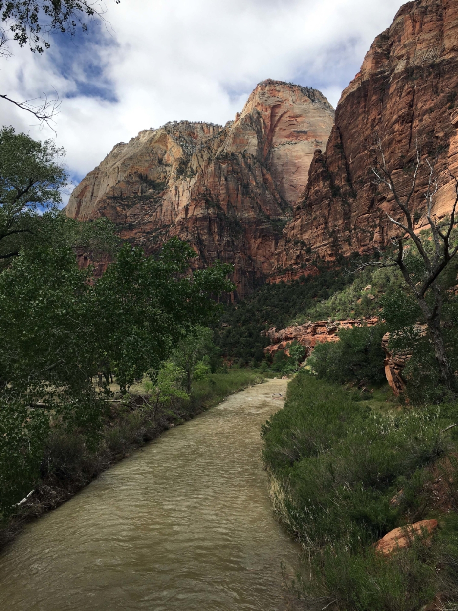
Zion National Park
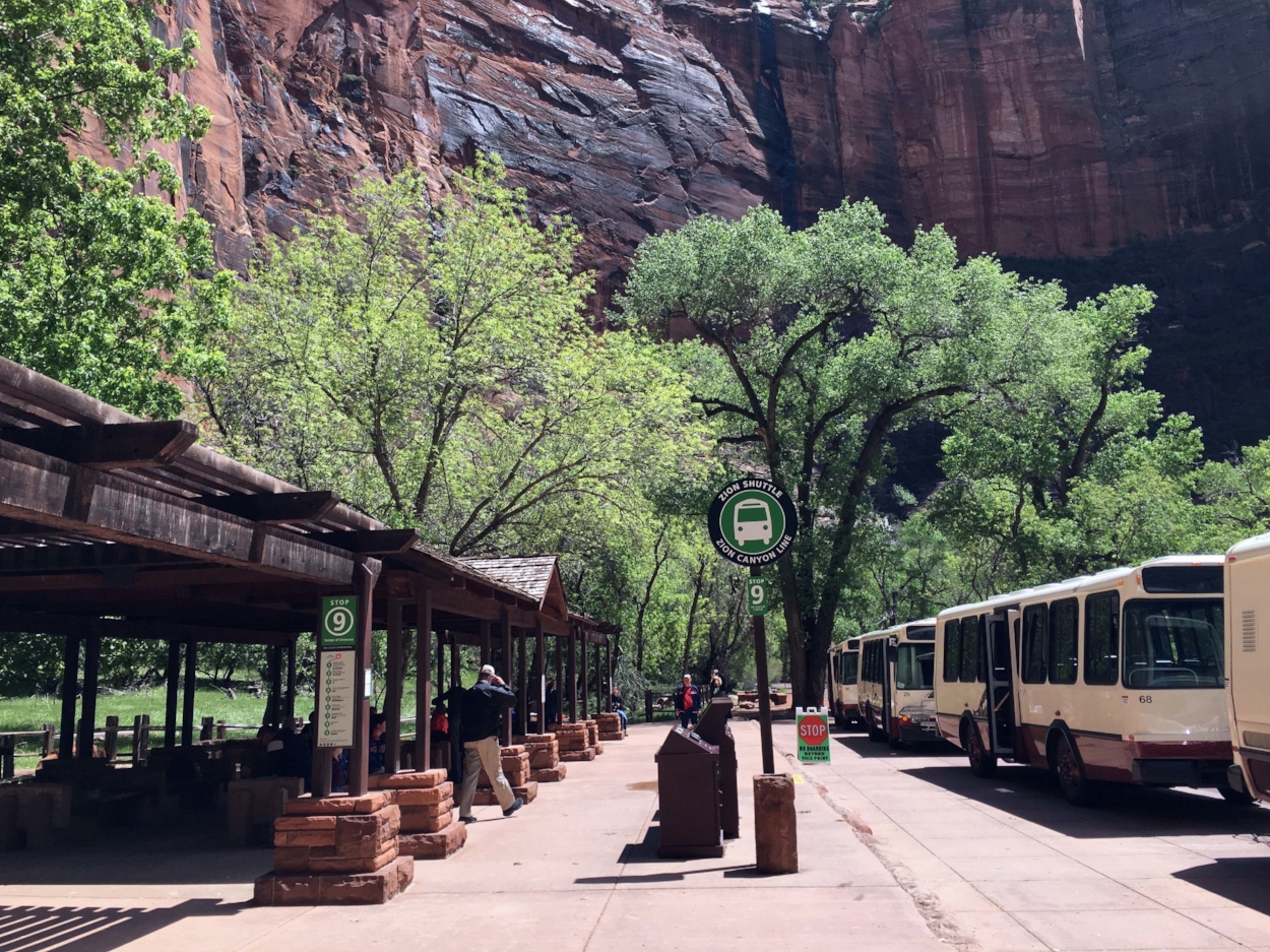
NOTE: Zion National Park shuttle ticket system is discontinued. Tickets for the shuttle will no longer be needed starting Friday, May 28, 2021. The shuttle returns to the usual waiting line. The pinch point will once again be the visitor’s center parking lot, which can easily fill by 10am or earlier on busy days.
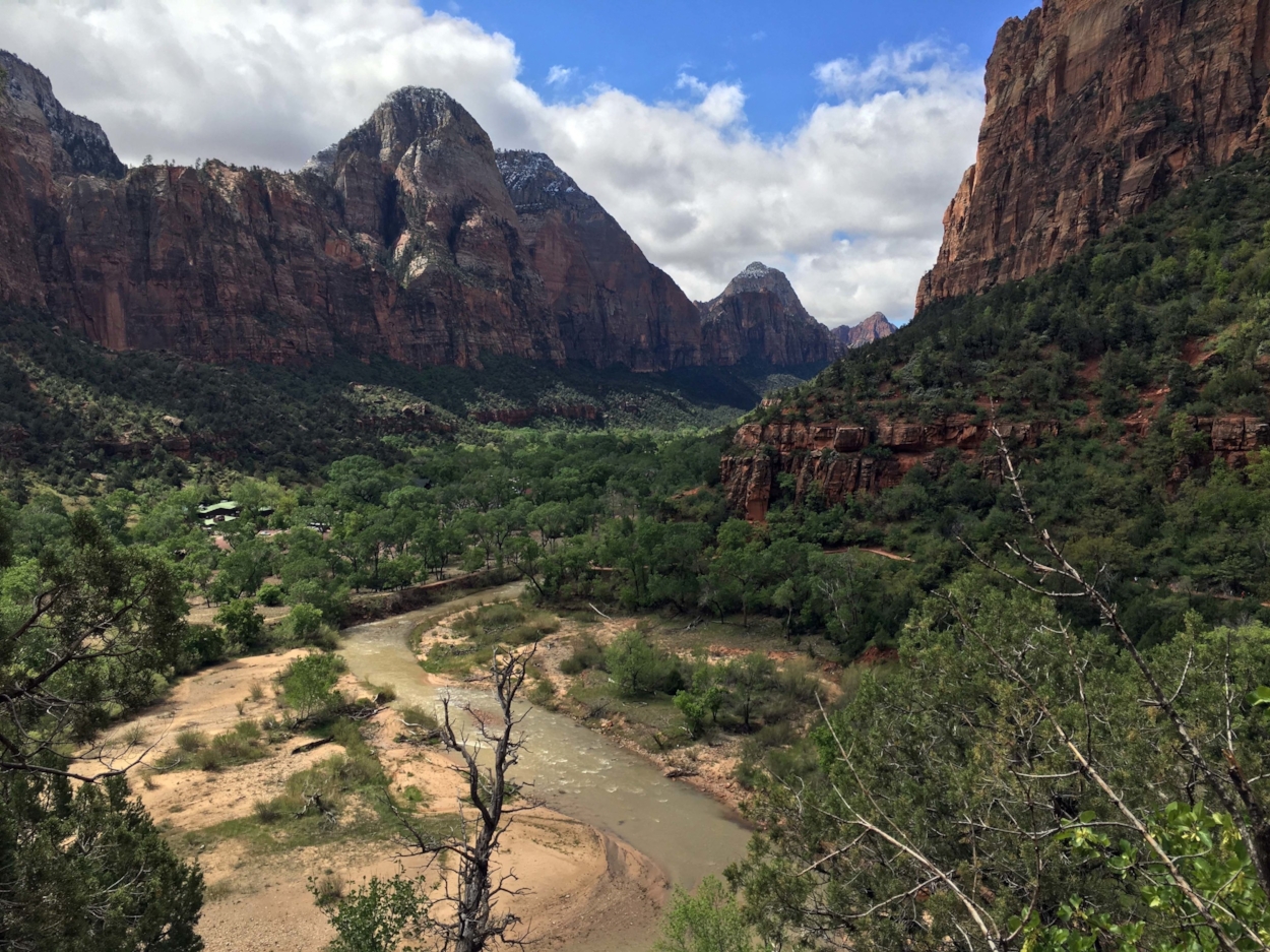
The Zion Canyon shuttle brings visitors to the northwestern portion of Zion National Park via the Zion Canyon Scenic Drive, stopping at landmark formations like Court of the Patriarchs, The Grotto, Big Bend, and Temple of Sinawava. For most of the year, the shuttle is the only way to access the park drive, as private vehicles are not permitted beyond Canyon Junction, where the state highway veers west. If lodging at one of the chain hotels in Springdale, just outside of Zion, an auxiliary shuttle will pick you up at a stop quite near your hotel, and bring you to the visitor’s center. This avoids the visitor’s center parking lot craze; the lot can often fill up by 10:00 a.m.. Zion Lodge is the only lodging within the park. It is managed by Xanterra, and there are a mix of historic cabins and hotel rooms, at roughly $220 a night before tax. We opted for a cozy AirBnb, not far from the park.
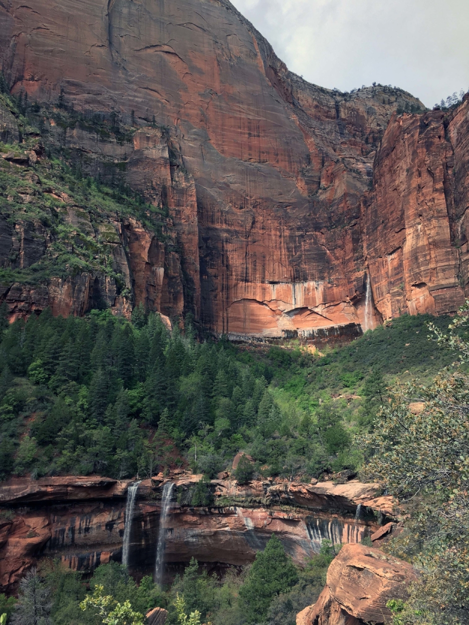
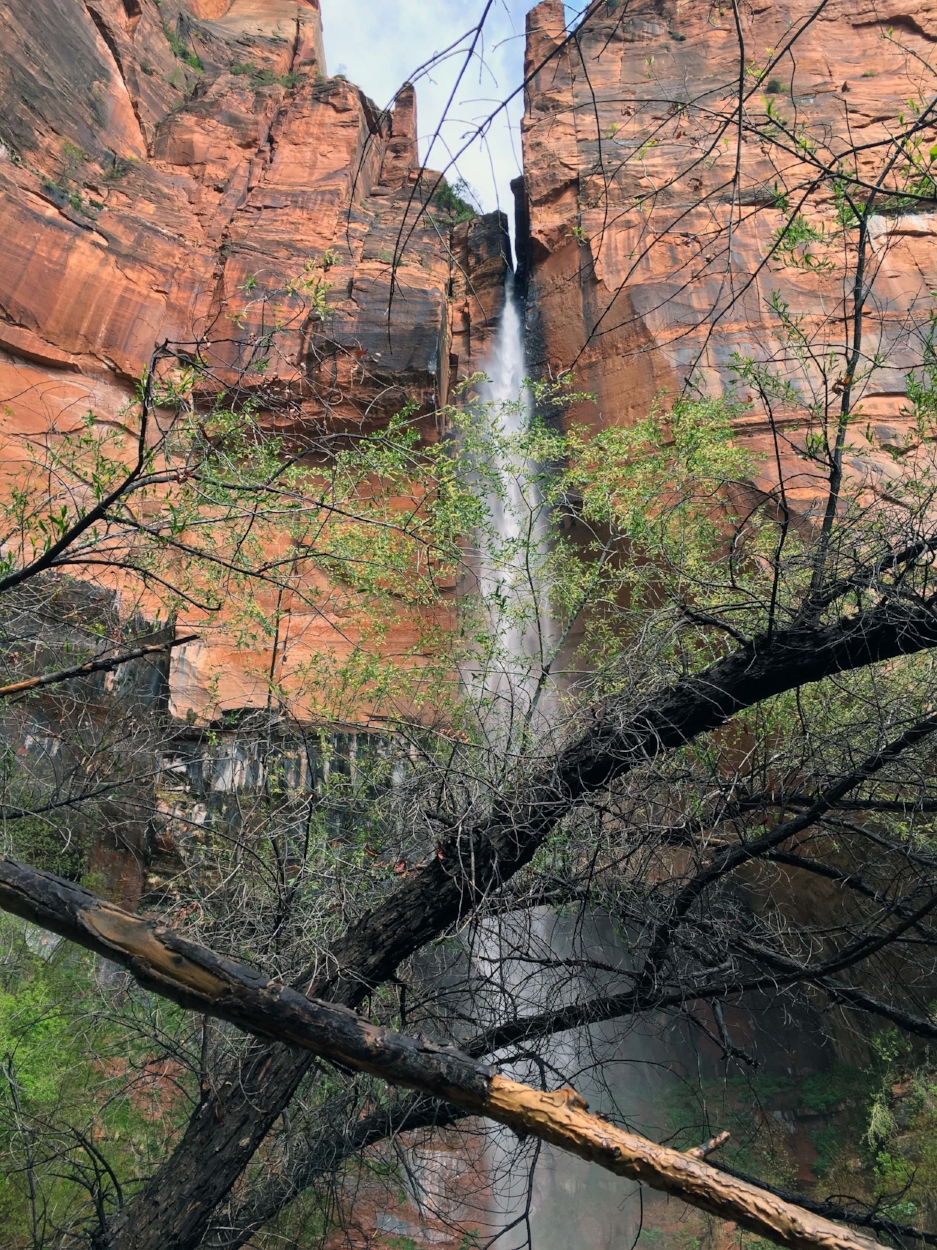
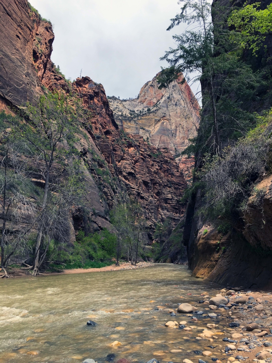
Hikes range from 30-minute walks to overnights, as well as guided tours on horseback. Short trails that we particularly enjoyed were the Riverside Walk, the Watchman, the Emerald Pools via the Kayenta Trail (make sure to go to the upper pool, especially if it has rained recently, as the waterfall there can be amazing). The Riverside Walk ends at the start of The Narrows, a half or whole day hike in itself that wades through the Virgin River between close canyon walls. The Narrows trail closes after periods of heavy rain. High on the recommendation list of hikes with breathtaking views and a satisfying climb is Angels Landing. Sadly, both Observation Point and Hidden Canyon are both closed long term due to a large rock fall. Technical climbing and canyoneering at Zion are recommended only for those who have previous experience.
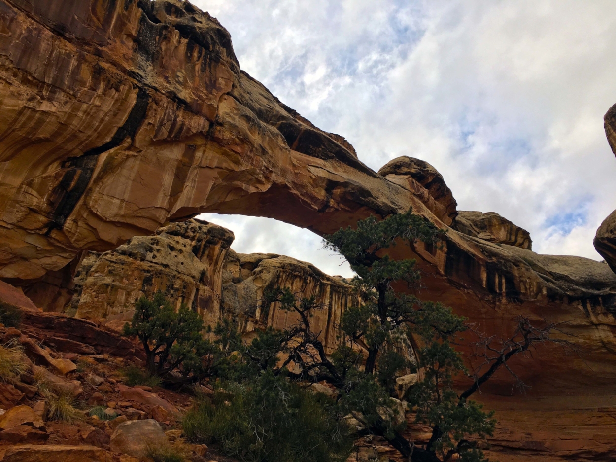
Kolob Canyons is the northwestern part of the park, with its own entrance right off I-15. There is a scenic drive up the Kolob Canyons road, accessing the trailhead to an easy one-mile round trip hike that ends with stunning views of the canyons and the surrounding countryside. This part of the park also accesses the eight-hour trail to Kolob Arch, which is the third longest natural arch in the world.
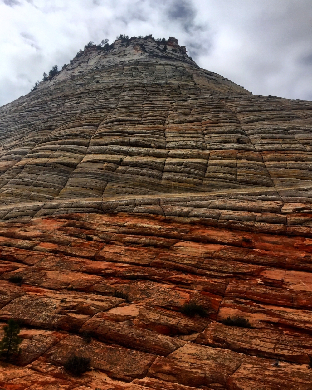
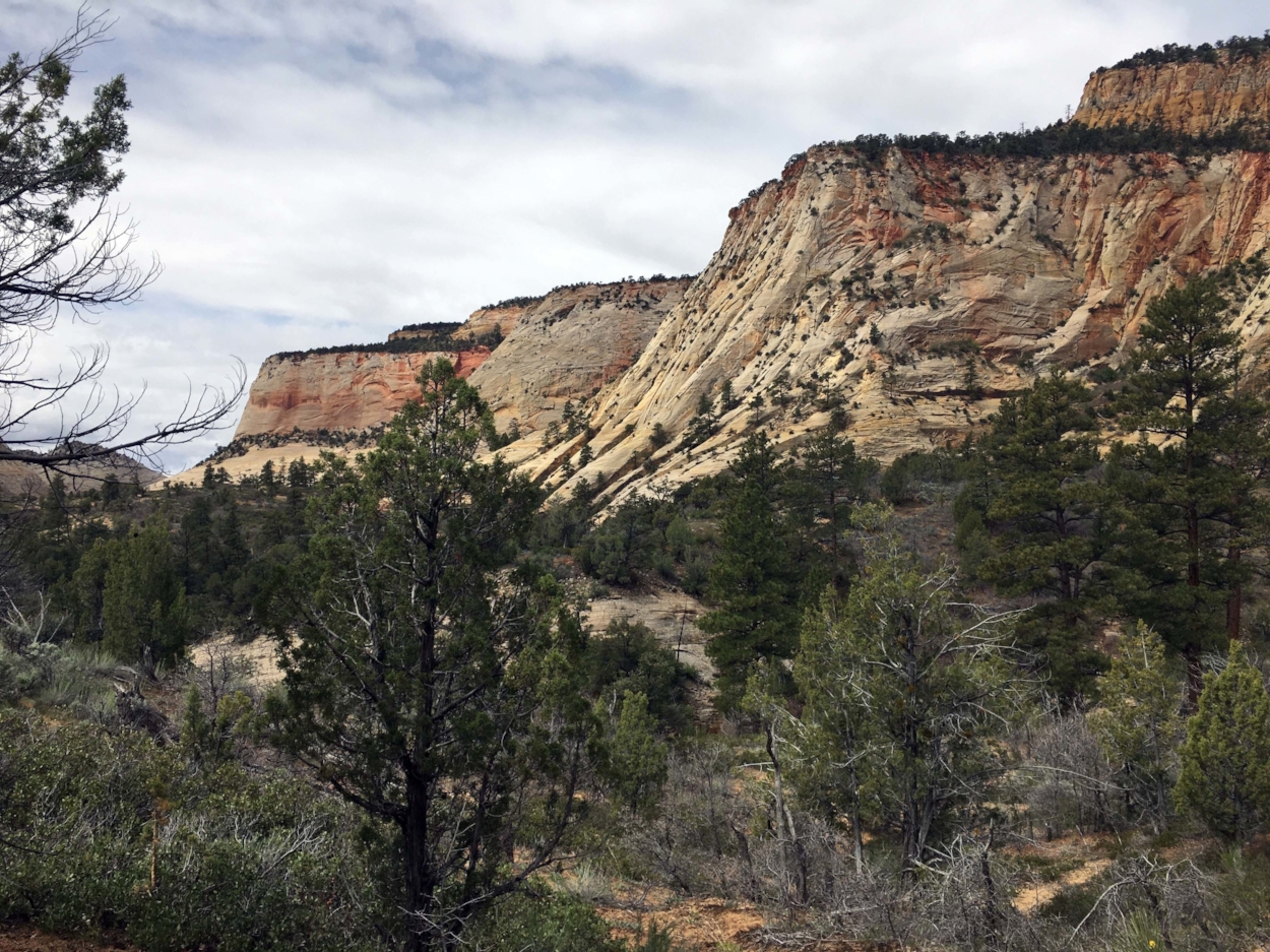
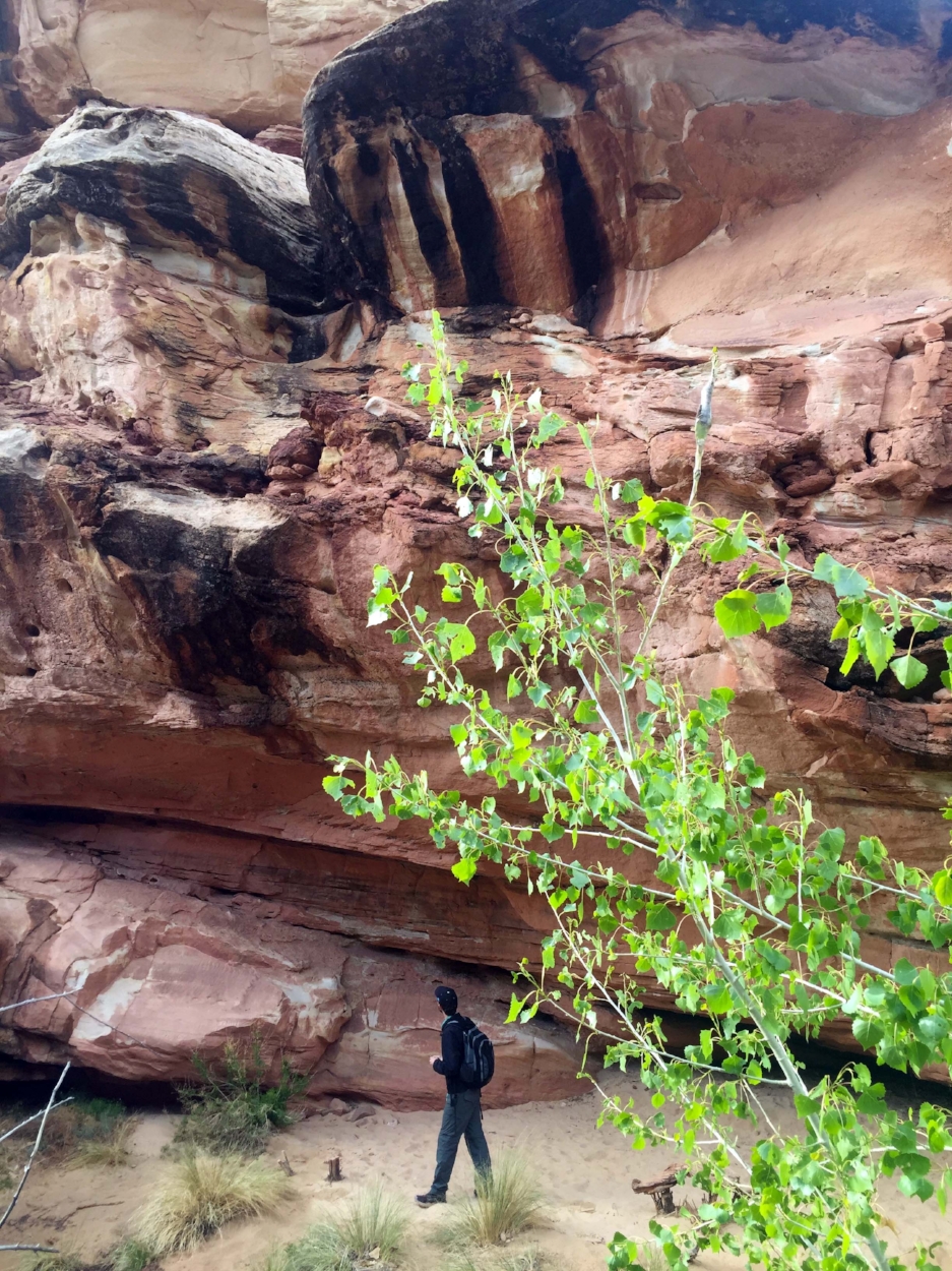
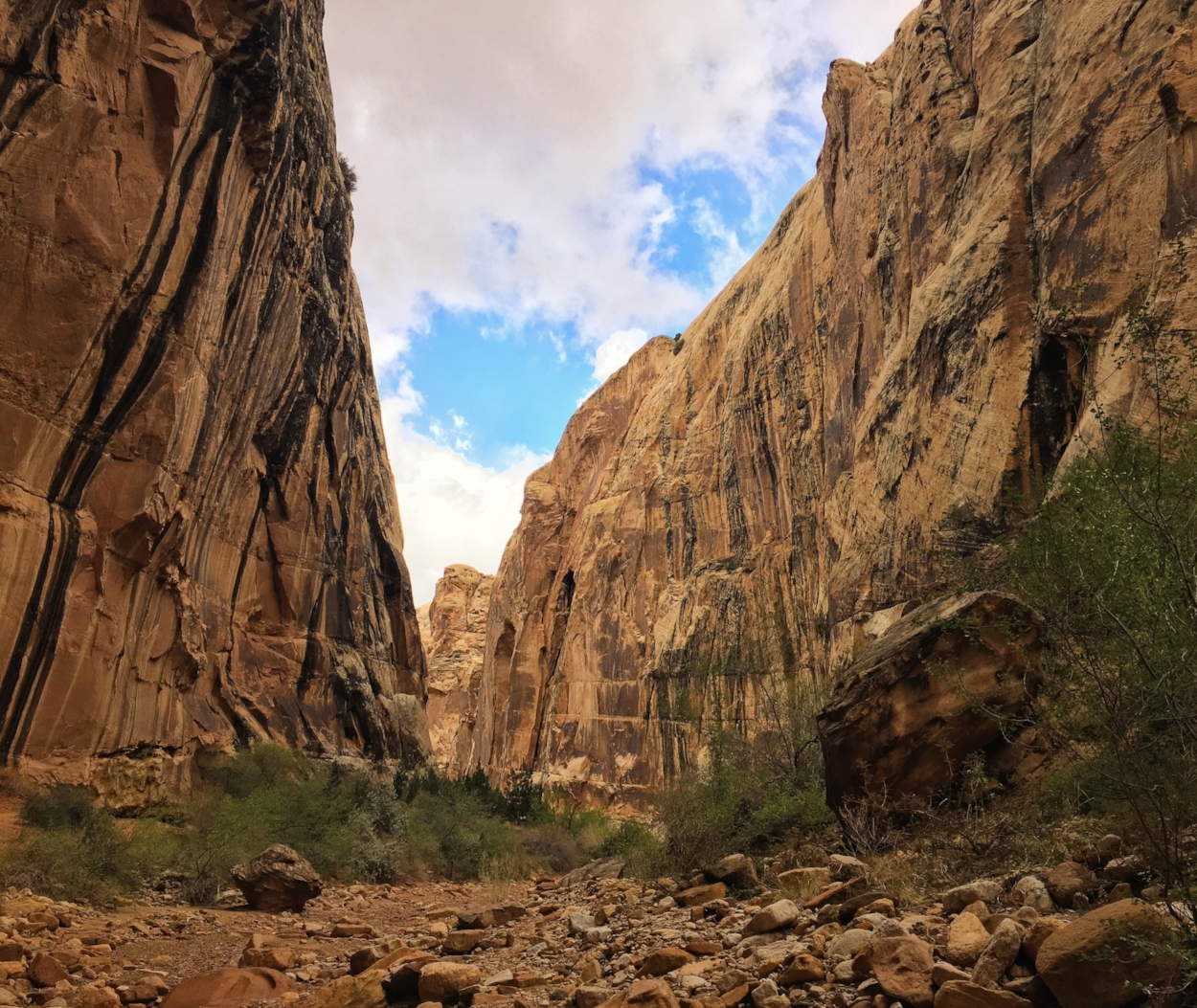
Before departing for Bryce, we explored the east side of Zion, which differs from the main portion of the park; few other than hearty hikers and campers occupy this part of the park. The highlight of journeying into the eastern region of Zion, which is en route to Bryce, is traversing the Zion-Mount Carmel Highway, a narrow winding road through the mountains and the mile-long Zion Tunnel, built in 1930. There are six galleries in the tunnel, with aperture views of the canyon as you drive by (no stopping allowed) — quite a memorable way to approach the next leg of the journey! The short Canyon Overlook trail is located almost immediately after exiting the tunnel, and parking is incredibly limited. The East Rim Trail is a longer trail through arid climes with dramatic sandstone promontories; a whole day traversing this trail will bring you to Weeping Rock, one of the nine shuttle stops in the busier portion of the park, to the west. There is ample parking for this trail, near the Zion east entry gate. On your way, stop at Checkerboard Mesa, where the cross-bedded sandstone has impressed hatch marks on towering, two-toned rock.
From here, the journey to Bryce Canyon National Park is a brief hour and half through the more arid part of Utah. It’s a beautiful drive, which passes through Dixie National Forest, where short walks through red rock hoodoos are easily accessed from the roadside visitors center, foreshadowing the striking scenery to come in Bryce Canyon.
Bryce Canyon National Park
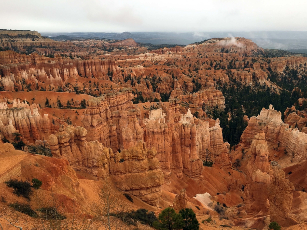
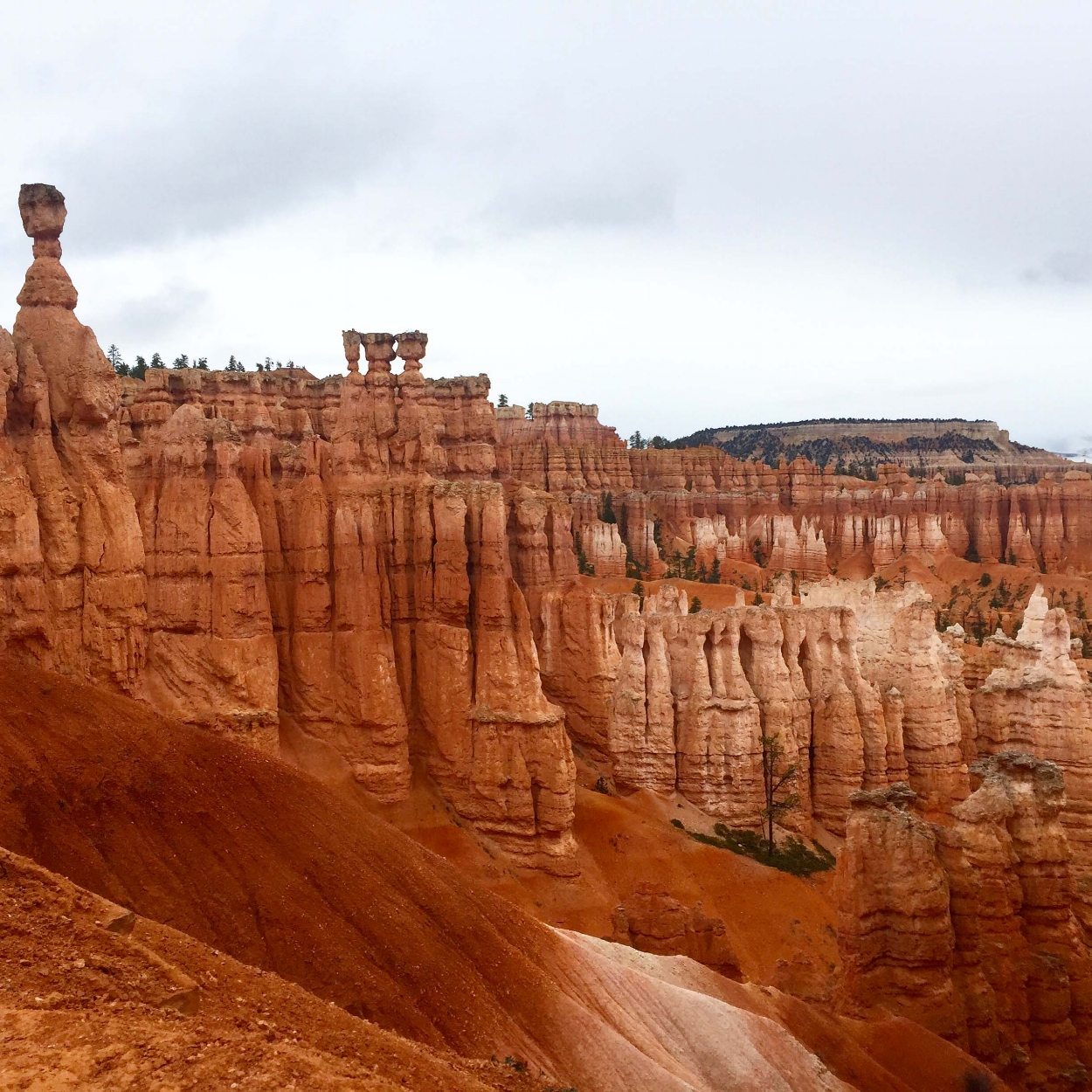
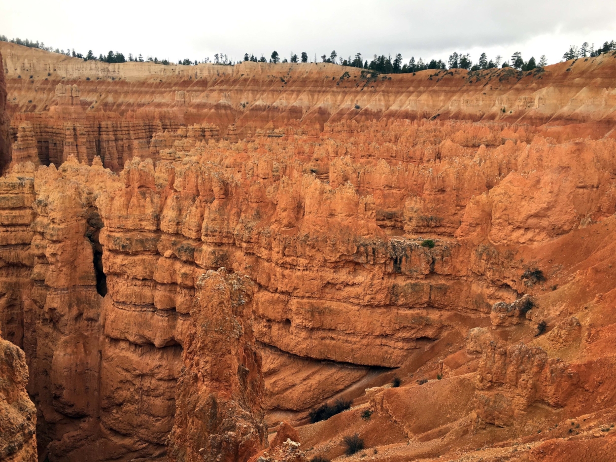
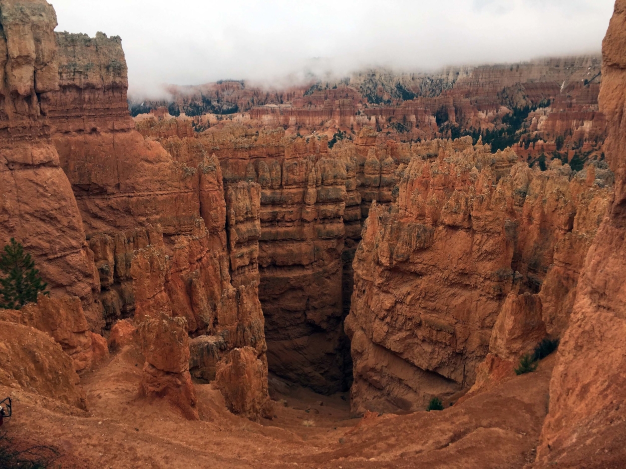
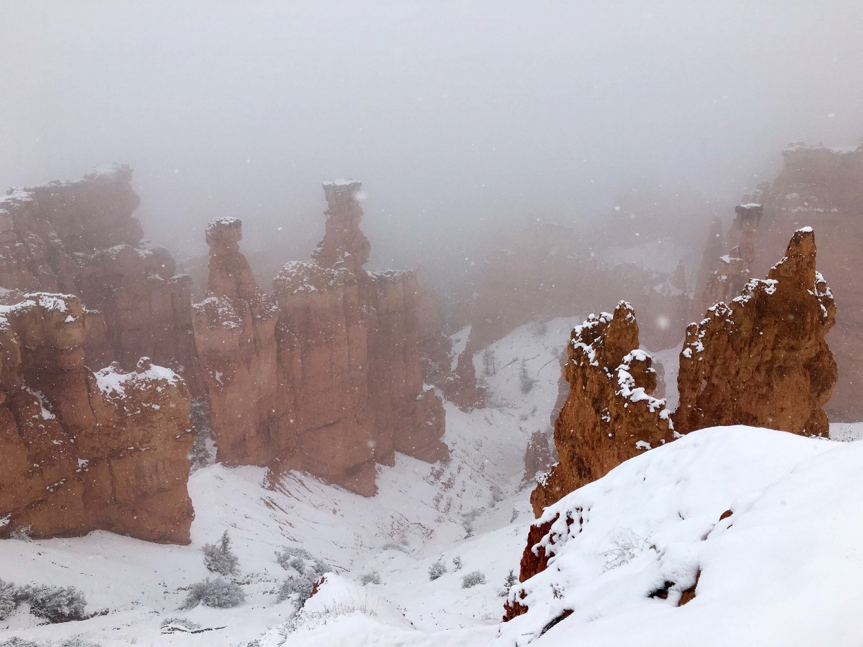
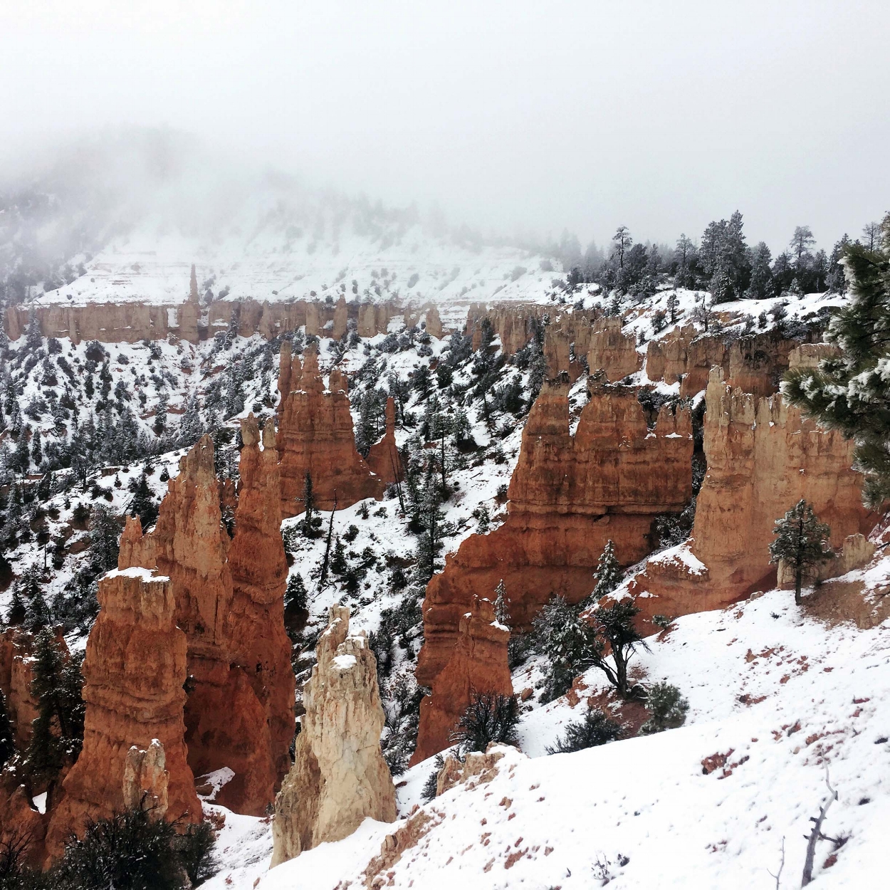
Bryce Canyon National Park is the smallest of the five Utah parks, at roughly 55 square miles. It is the second smallest national park in the system (the smallest is Hot Springs National Park, in Arkansas), yet is extraordinary.
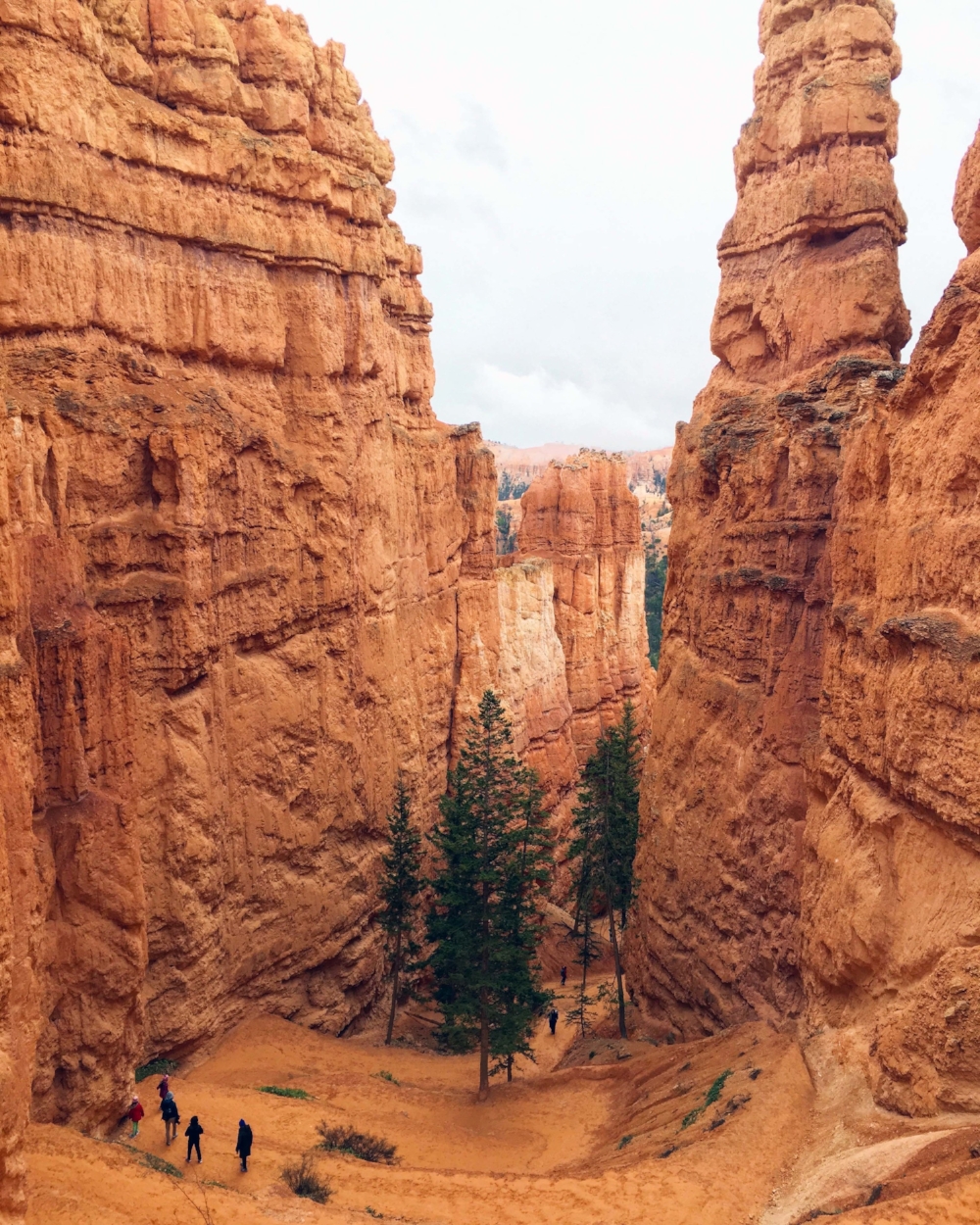
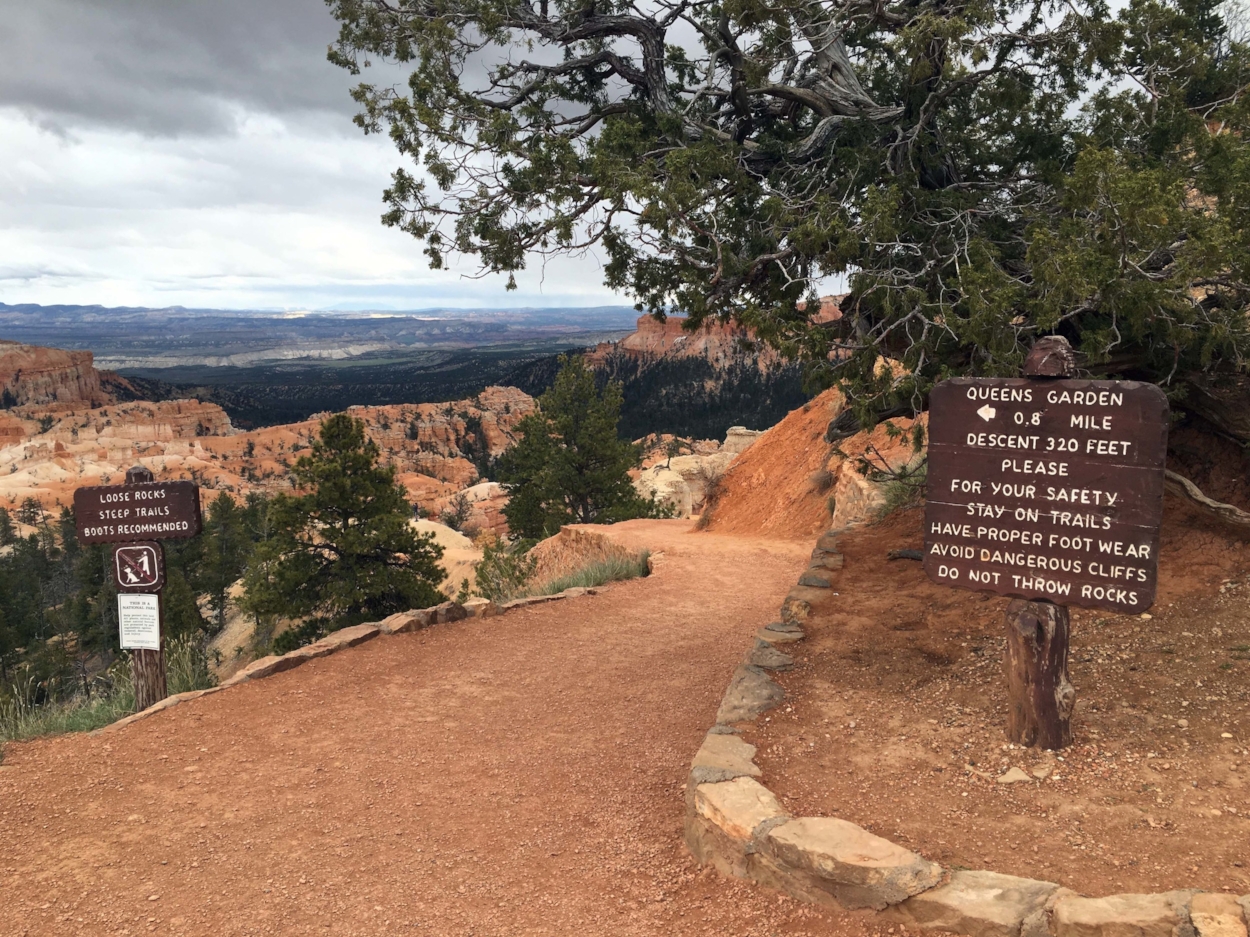
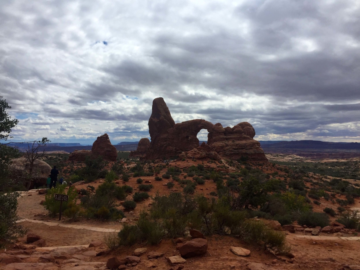
The best way to explore Bryce’s hoodoos, windows, and walls is by hiking into the canyon and walking among the formations. The Queens Garden to Navajo Trail loop is a two-hour adventure, descending about 360 feet, to the floor of the canyon. As you venture further and further down, perspective changes vastly, until the seemingly far away hoodoos are towering over you. If you want a more isolate trail with less visitors, head to Fairyland point. The turn off for this area is actually before the park gates, though it is part of the park. You will not need to pay the park entry fee if you are only visiting Fairyland.
If hiking downhill and uphill is not preferred, a short 1 mile roundtrip walk between Sunrise and Sunset points on the Rim Trail, paved and with very little elevation change, is a great way to get a feel for the scale of Bryce. The entirety of the Rim Trail is 11 miles roundtrip, and winds the upper edge of the canyon, with startling views of the village of spires below. Bryce is about 2,000 feet higher in elevation than any of the other parks, so do take that extra few minutes to stop along the way while hiking if needed.
Further points, like Rainbow Point, Natural Bridge, and Agua Canyon, are accessible via the park drive. With moderate traffic, the drive from the gates of Bryce to the end of the park drive, Rainbow Point, is 18 miles and takes about 40 minutes, one way. The park shuttle is highly recommended, especially in the summer season, as parking can be a challenge. The free shuttle starts just outside the gates of Bryce in a sizable parking lot.
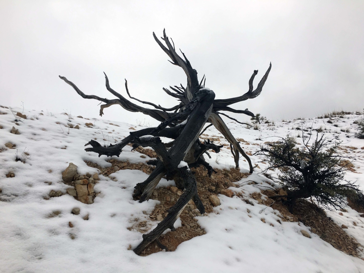
A note on weather: At Bryce, the summer highs are occasionally in the 80’s, while at night temperatures will dip into the 50s or 40s. Layers will be helpful, as well as monitoring the daily forecast. The unofficial summer season is from the first week of May until the first week of October. Especially outside of those dates, the weather can be unpredictable. It snowed several inches during our April visit! Since winter weather is actually a norm for Bryce, the park has cross-country skiing and snowshoeing trails open and groomed. Many places in town will rent snow related gear.
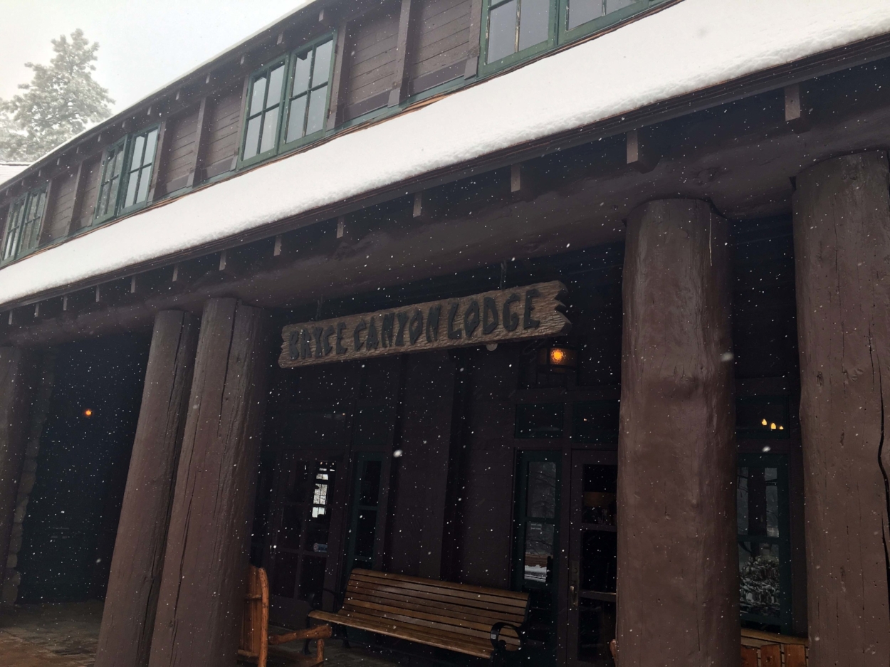
In terms of accommodation, there are a handful of Best Westerns in town with historical ties to the region. Ruby’s Inn Best Western Plus is the largest accommodation in terms of rooms. In the main residence at Ruby’s are many amenities; a restaurant, general store, pool, and Jacuzzi. We found Ruby’s, located just outside of the park, convenient and inexpensive. Forever Resorts operates the Bryce Canyon Lodge within the park, a 1930’s lodge with both western cabins and motel-style rooms; prices hover a bit over $200 a night before tax and are often sold out months in advance. “The Lodge” is seasonal, from March to November. Camping or RV sites at Bryce can be reserved in advance, though most of the spots are first-come-first served. Prices range between $20-30 a night.
Capitol Reef National Park
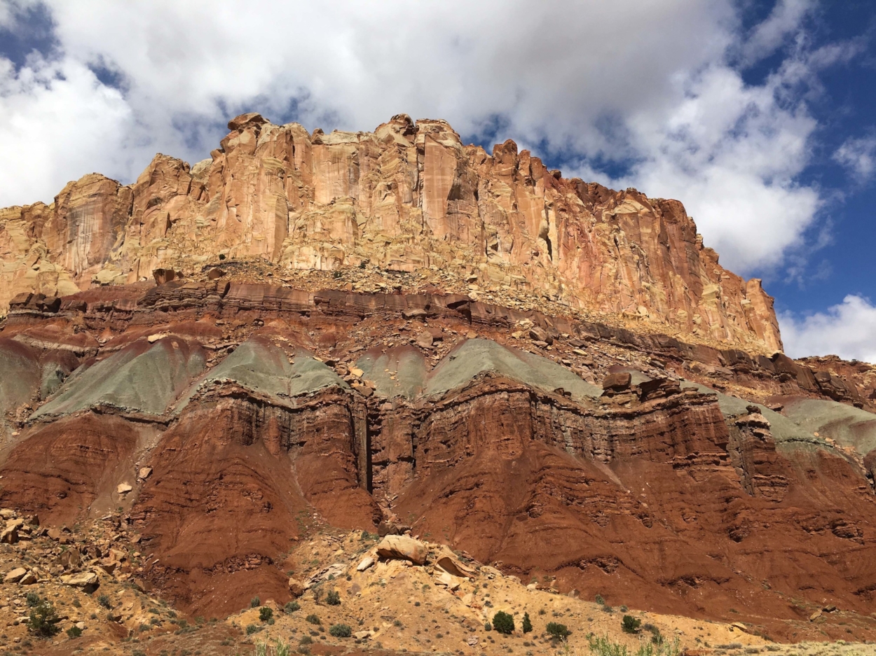
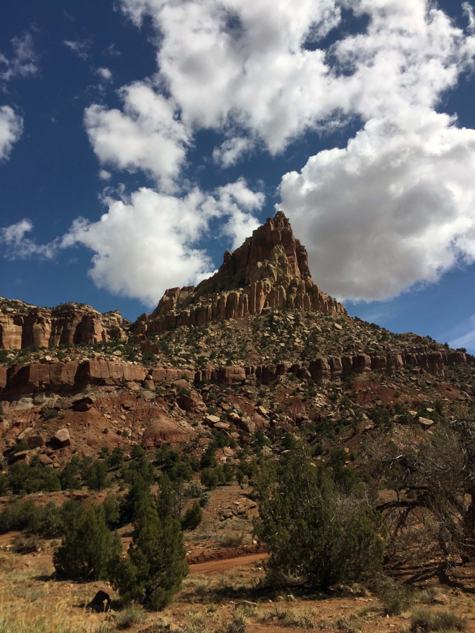
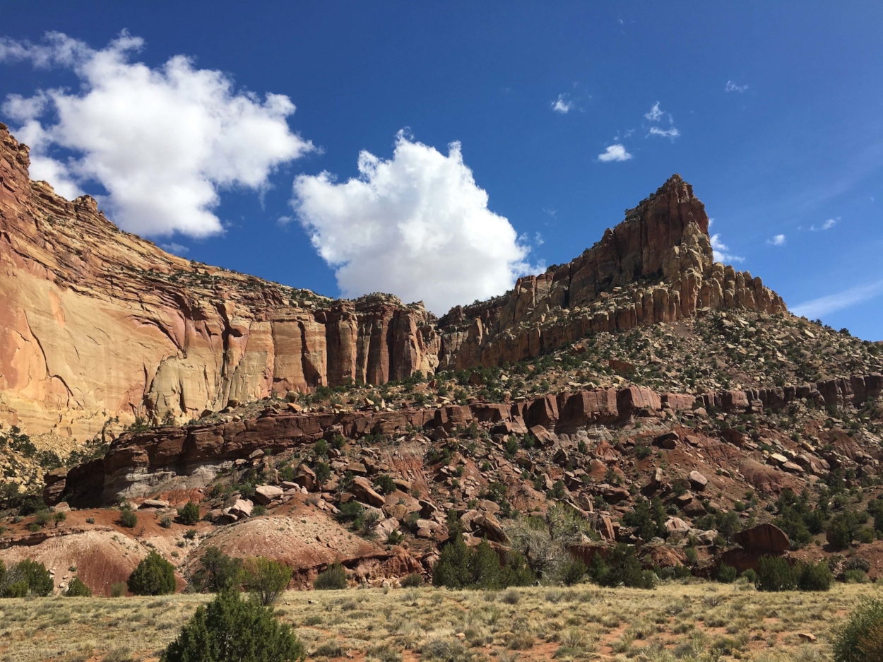
Capitol Reef National Park is nestled in central Utah, some distance from any of the other parks; hence, getting there does entail some planning. The park is approximately two-hours by car (100 miles) from Bryce. You can choose between two scenic byways that progress through stunning landscapes to get there. State Route 12 traverses the mountainous terrain of the Grand Staircase, or Escalante National Monument. Alternatively, Utah’s State Route 22 to State Route 24 journeys through the high plains. Either way, the landscape of buttes and rises studded with sagebrush and chaparral swells around you awesomely; Route 12 may be more difficult in winter weather conditions due to higher elevations and more twists and turns. Once in Capitol Reef, you will notice a fraction of the crowds compared to Zion!
Two hundred million year old canyons, domes, ledges, and uplifts convey a prehistoric sense of the area as untouched by time. Note as well that at Capitol Reef, “Half the Park is After Dark;” this park is also an official International Dark Sky Park, where high quality nighttime skies are rarely seen in such an accessible way.
Your entry toward the Visitor Center is heralded with sandstone monoliths from four significant geologic eras, and views of the Fremont River as it cuts a canyon through the land. This area is known as the Waterpocket Fold, a 100-mile long stairstep fold in the Earth’s crust, uplifted millions of years ago. The erosion that continues to this day creates the amazing features of Capitol Reef. The name of the park originated from one of the dome formations thought to resemble the U.S. capitol dome. As a nautical term, a “reef” indicates a blockage; the huge formations on the Waterpocket Fold initially blocked further travel west in this region, until nineteenth century settlers cleared large boulders by hand to form a viable route.
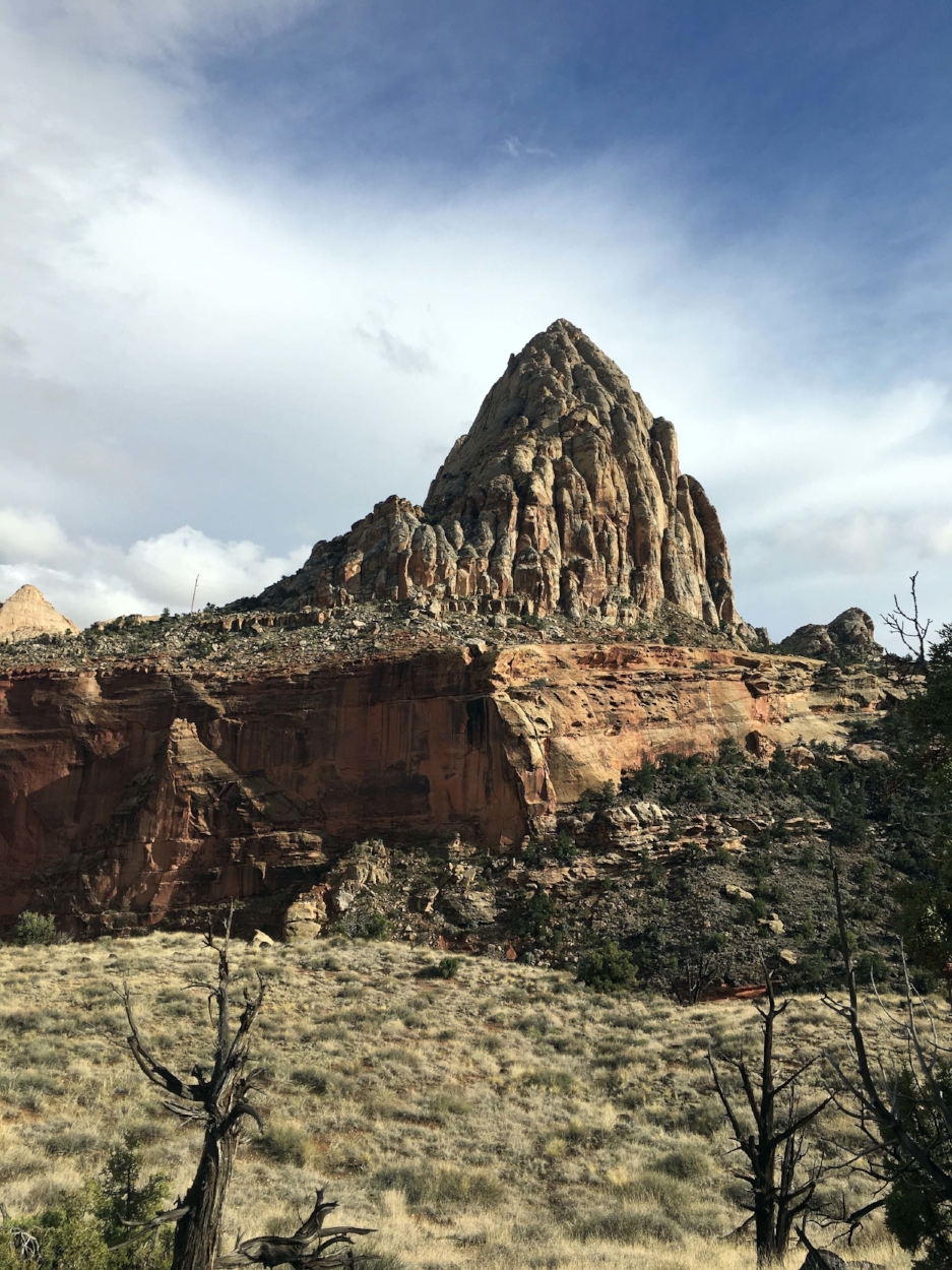
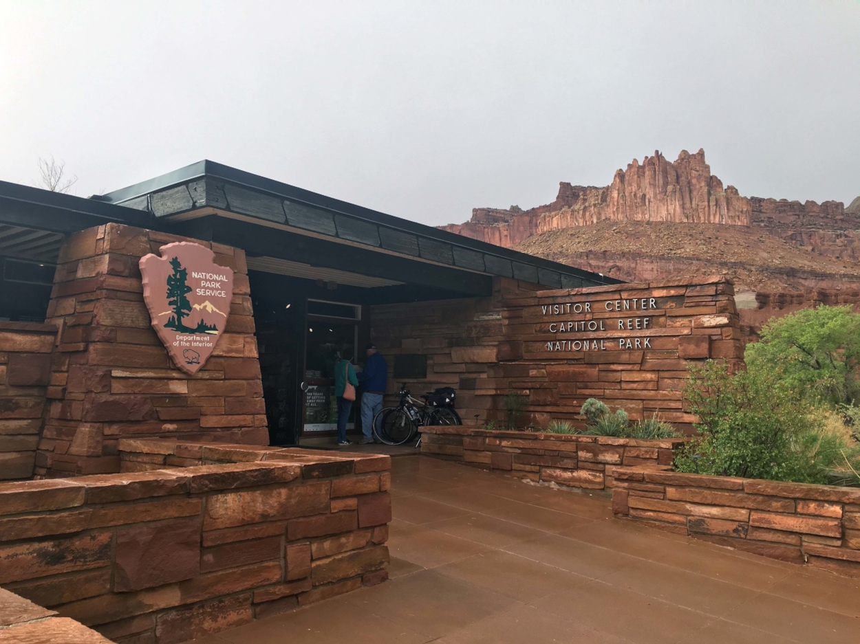
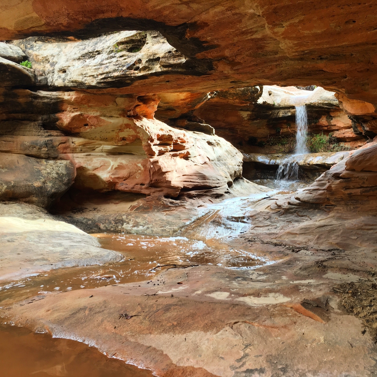
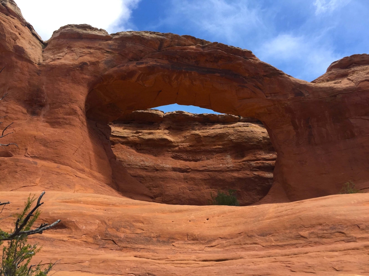
Check in for current info on trail and road conditions with rangers at the visitors’ center, as heavy rains and lightning can prompt short-term closures. Great hiking trails include the Cohob Canyon, Grand Wash, Capitol Gorge and Hickman Bridge. The Grand Wash is similar to The Narrows in Zion, as it weaves through a riverbed; however, unlike The Narrows, the Grand Wash is often dry or slightly muddy — you will not be wading. There is almost no elevation gain on the hike, and the canyon walls around you seemingly reach to the sky as you progress. A tip for the Grand Wash trail in particular — the parking lot off the scenic drive park road can fill quickly. You can begin this trail at either end though, and off of Route 24, there is more parking, and closer to the more dramatic portion of the trail, through the canyon. Near to the visitors’ center, the Hickman Bridge trail is a relatively easy hike that takes roughly two hours, round trip; the bridge is 125 feet high and 135 feet long. We took along the interpretative map (fifty cents at the trailhead) and learned a lot about the flora and fauna of the trail, the black andesite lava that landed atop many of the mounts during the last Ice Age, and the effect of acid and groundwater on the surrounding formations. Petroglyphs from the Fremont Culture (contemporaries of the Anasazi) dot the park, including by Hickman Bridge and on the Grand Wash trail; the park is unique in that it retains distinct traces of people and cultures who have called the area home.
Unless you are going on the eight-mile scenic drive, there is no park entry fee. The drive is well worth the price of admission. Without stopping for a hike, we completed it in under ninety minutes. An interpretative map is available for two dollars in the visitor’s center. As the drive begins, you will see the ongoing preservation of the modern Fruita Historic District, a town and orchard originated by Mormon settlers in the mid 19th century. Fresh pies, cinnamon buns, preserves, pickles, quilts, and other period inspired home and kitchen supplies are for sale at the Gifford Homestead, an addition to the Gifford’s farm house; the Gifford’s were the last residents of the Fruita community to sell their land to the NPS, in 1969.
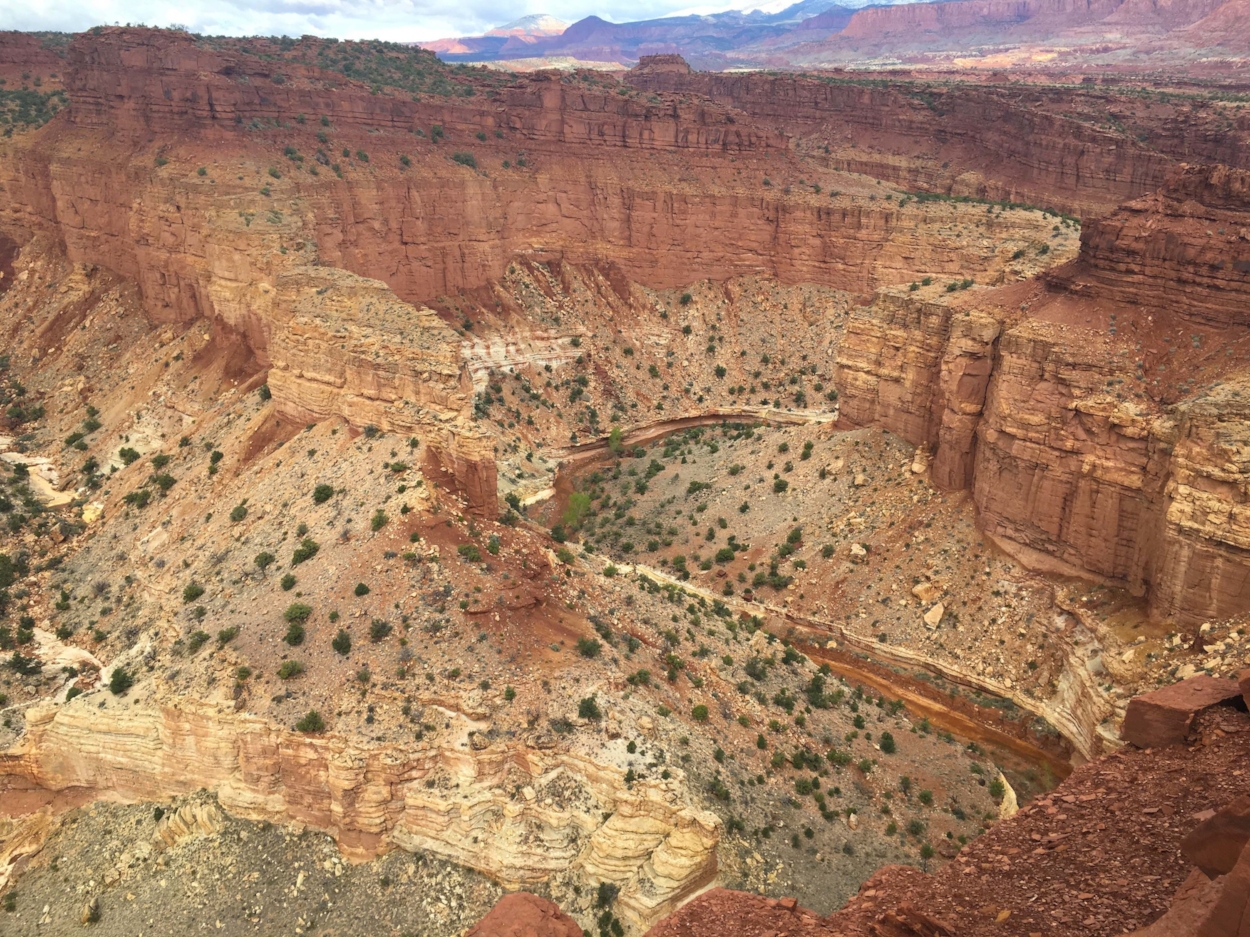
Several other districts comprise Capitol Reef, including Cathedral Valley, north of the scenic drive, and Strike Valley to the south. To access these parts of the park requires driving on unpaved roads, many of which are actually maintained. Having access to a four-wheel drive vehicle is important, and a high clearance vehicle for Cathedral Valley is almost a necessity due to the terrain of the roads to avoid becoming stuck.
The town of Torrey is an ideal place to base yourself, though the Day’s Inn is the only points earning hotel. The area is dotted with smaller inns and lodges, which can fill during high season. We advise arranging accommodations well in advance, as aside from Torrey, the next town is some distance. AirBnB is also a valuable asset on this part of the trip. Camping and RV spots are available, though are limited in number and are first-come, first served. You are permitted to camp in the backcountry, though you will need to register and obtain a free permit from the visitor’s center.
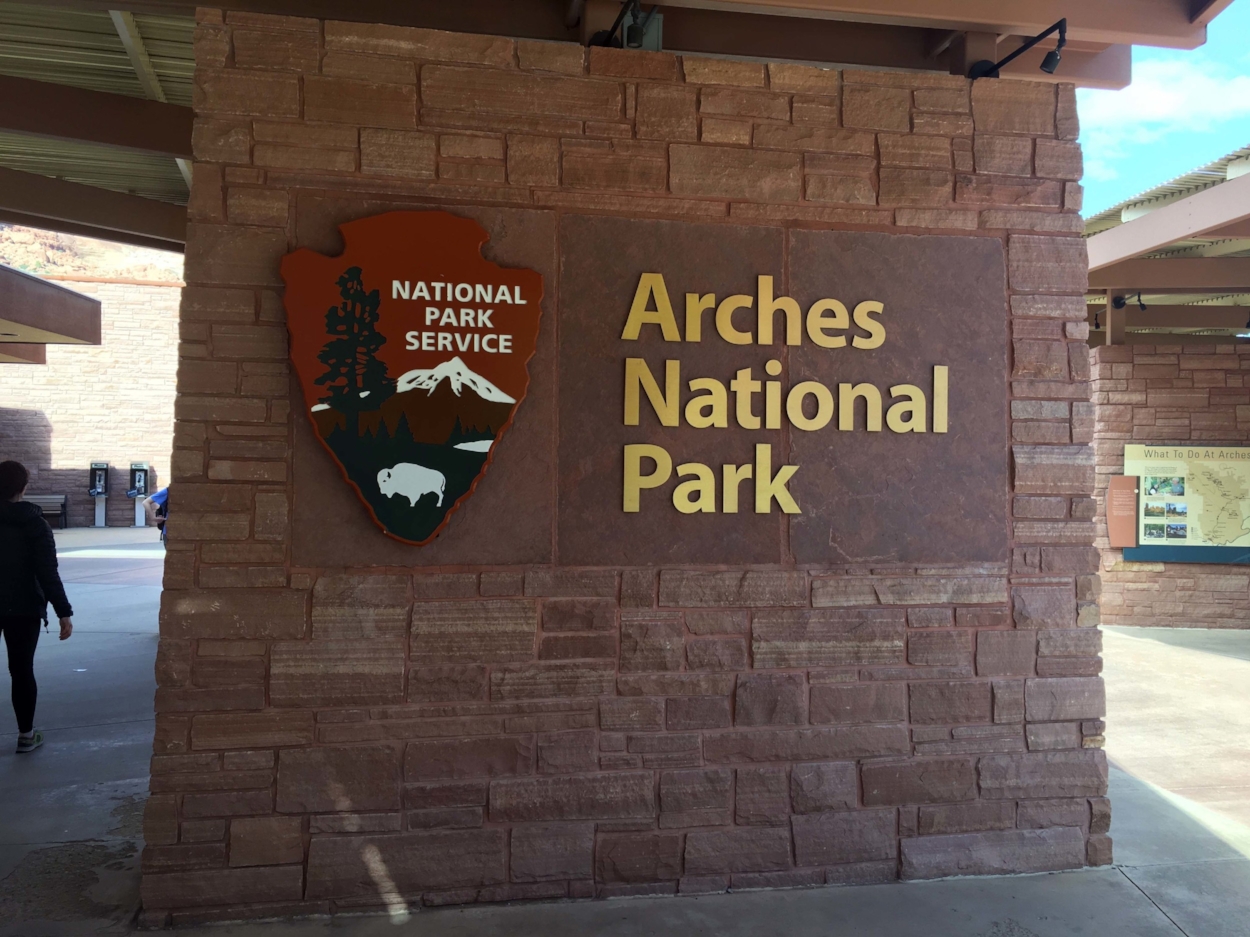
Arches National Park
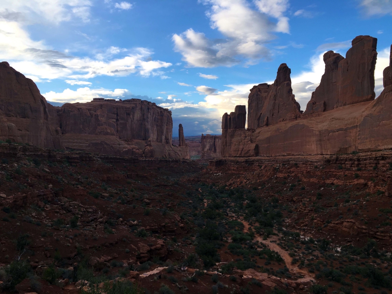
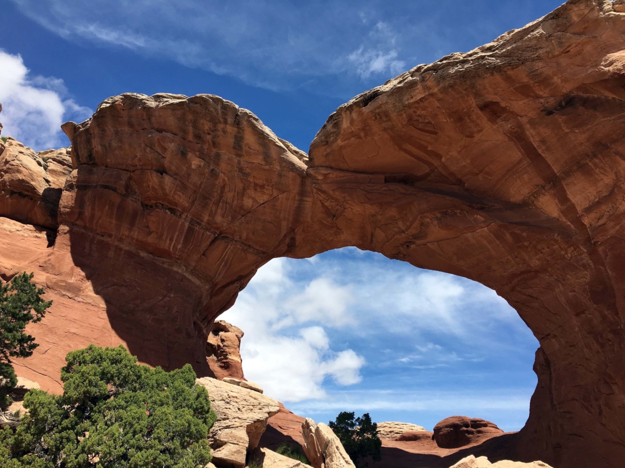
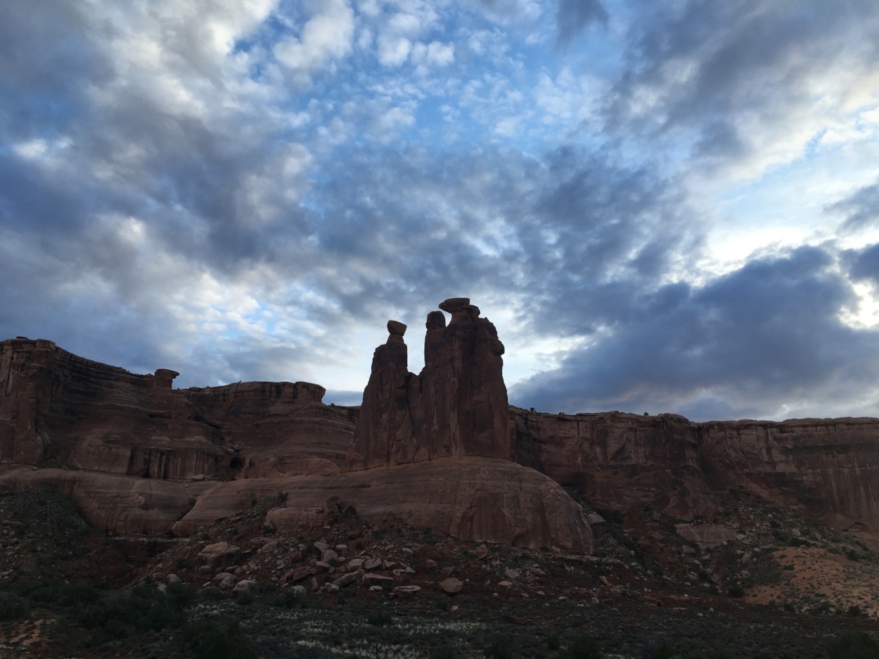
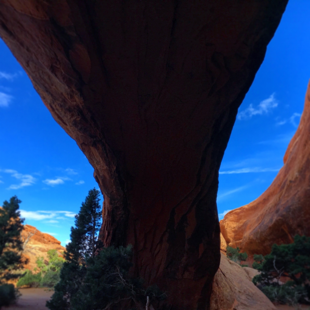
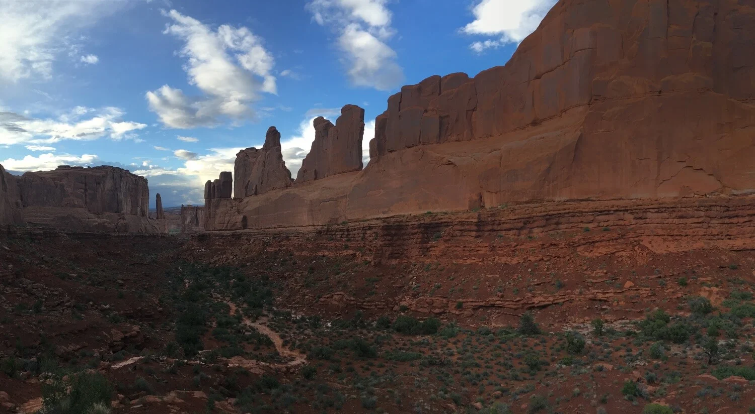
We drove two and a half hours to Moab during the late afternoon of our second day at Capitol Reef. Arriving at Arches National Park just before sunset was magical, as the park was sparsely populated and entrancingly lit. The entry to the park is a long, uphill road with more than one switchback, which opens to a large expanse of land that is punctuated by wonders of rock and erosion. From here, the distances between the rocks grow — no longer is there lush vegetation all around, the more arid climate of the land takes hold. The late day and early morning light highlights each geologic formation singularly; formations along the park road, which are seen best during sunset, named as site specific installations might be — Sheep Rock, Tower of Babel, The Organ, and so forth.
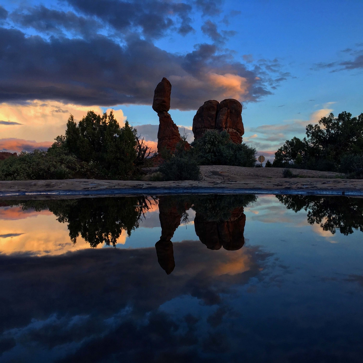
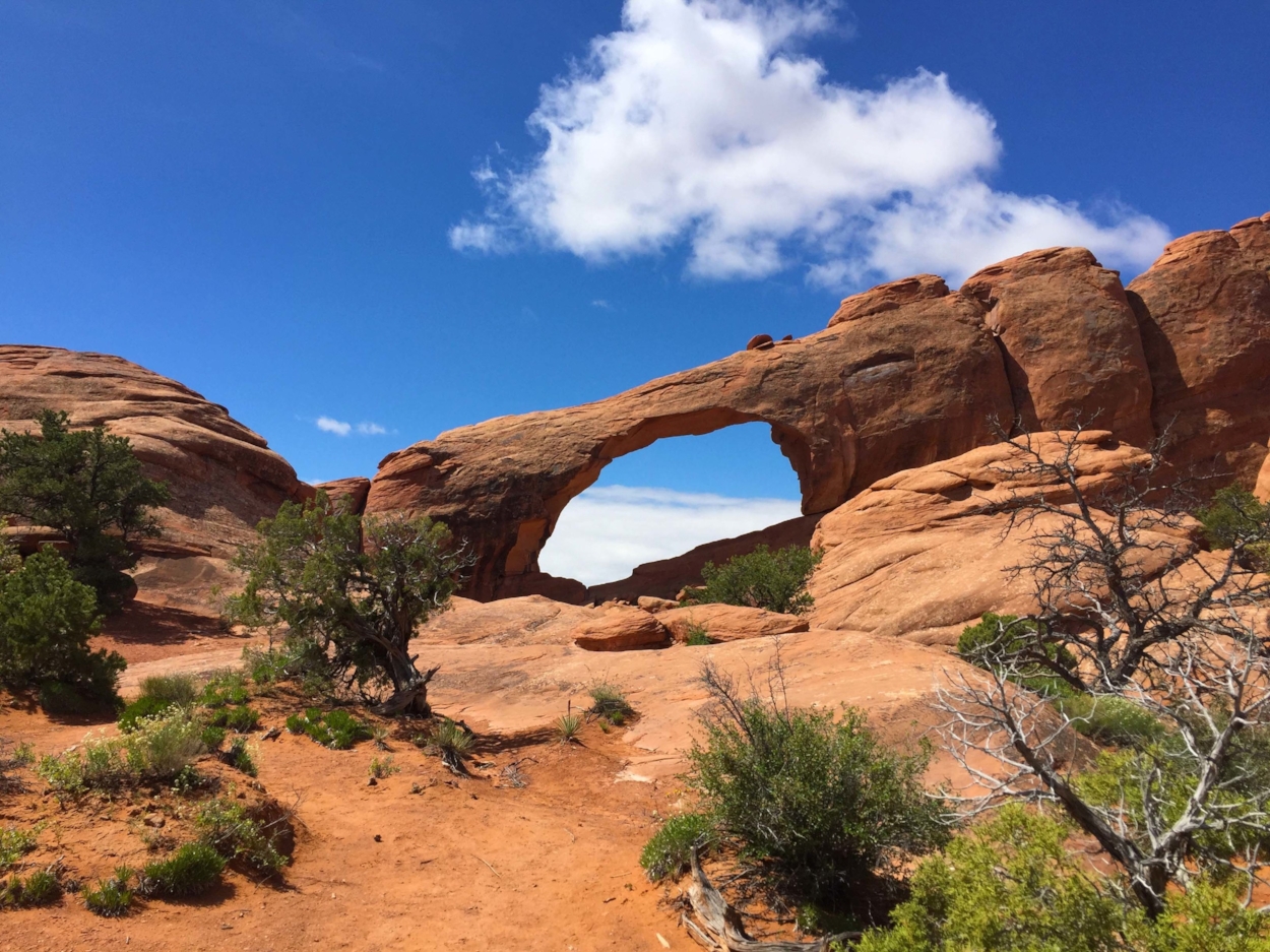
Exploring here in the early evening is like stealing time; we saw much of what we might have sought out during peak daytime touring hours, yet parking was a cinch, the evening temperature mild, and the waning sun created a range of silhouettes and golden light on the large scale formations. The Windows, Balanced Rock, the Great Wall, Courthouse Towers and Park Avenue are all rather close to the park entry, and accessible via brief walks.
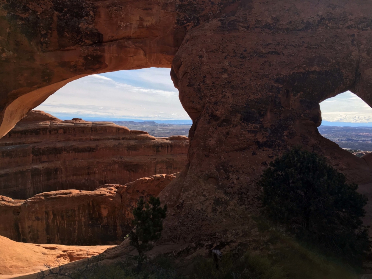
Arches National Park is quite popular and there is no shuttle system, so you will rely upon your car and available parking to see the sites. To that end, in 2022 the National Park Service started a pilot program that requires timed entry tickets to access the park from April through October. You’ll want to reserve your tickets roughly 3 months ahead of your visit. All tickets for a month are released at the same time, the 1st day of the month 8am Mountain time, 3 months before. For example, to visit in July, you would want to reserve tickets on April 1st. You do so on Reservation.gov. A very limited number of tickets for the next day are released at 6pm Mountain Time, again on Recreation.gov. There is a nominal fee to reserve, this is not the park entry fee. If you are completely out of luck, you can enter the park prior to 6am or after 5pm with no reservation needed. The park is open 24 hours a day. If you have a Devils Garden campground permit, backcountry camping permit, Fiery Furnace permit, you do not need a timed entry ticket.
The benefit of an early start to the next day cannot be stressed enough. We found it a good strategy to begin on the far side of the park, at the site we were most interested in (for us, that was Devil’s Garden), working back to the entry. The closer to the entry, the closer the sites are to each other, so if one lot is full, it’s not long to drive to the next. Temperatures are also naturally lower in the morning hours; particularly in summer, the midday sun is intense. Devil’s Garden and Delicate Arch are two parking lots that will fill up early, and since long hikes begin at both, the lots have less vehicle turn-over.
We won’t get too involved in picking your trails, though the hike to Delicate Arch is a three hour round trip to see one arch, while Devils Garden has nine arches in short distances from each other, some fun scrambles though relatively easy hikes, and a lot less foot traffic.
Finding accommodations in Moab won’t be hard at all; each major hotel chain maintains at least one property (lower tier, generally) in the city along with several independent motels and some really nice B and B’s. If booking on points, redemption rates can be more premium than usual, though good bargains are also possible, depending on the timing. Moab is also a good city to use free night certificates, especially if you have a credit card that offers one each year on renewal.
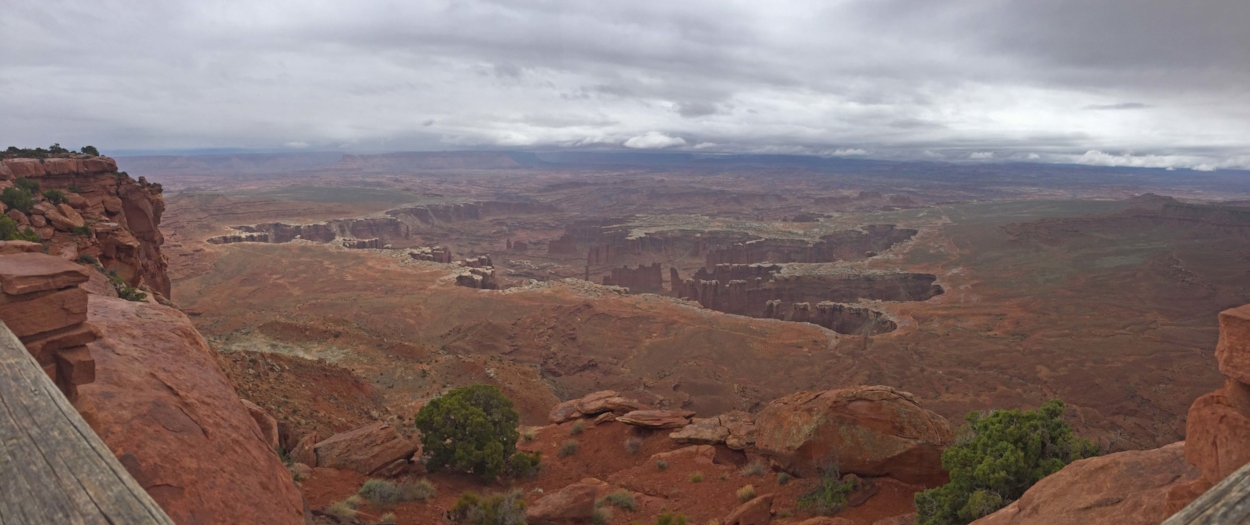
Canyonlands National Park
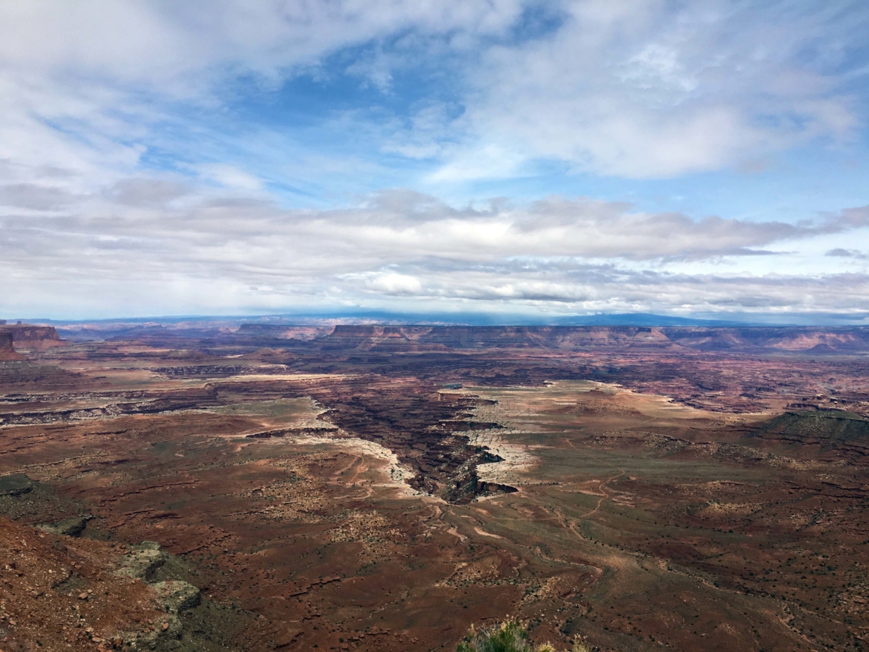
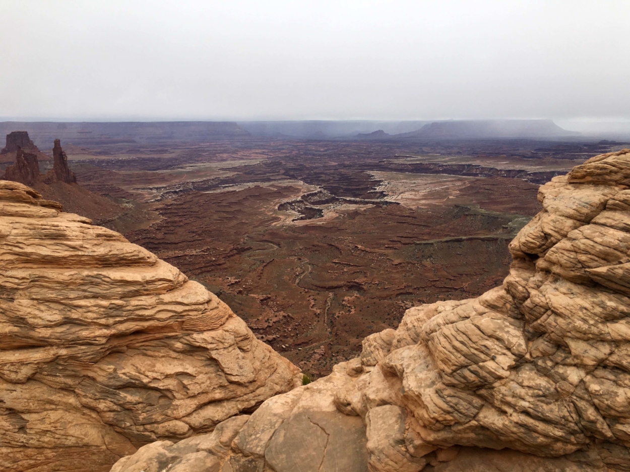
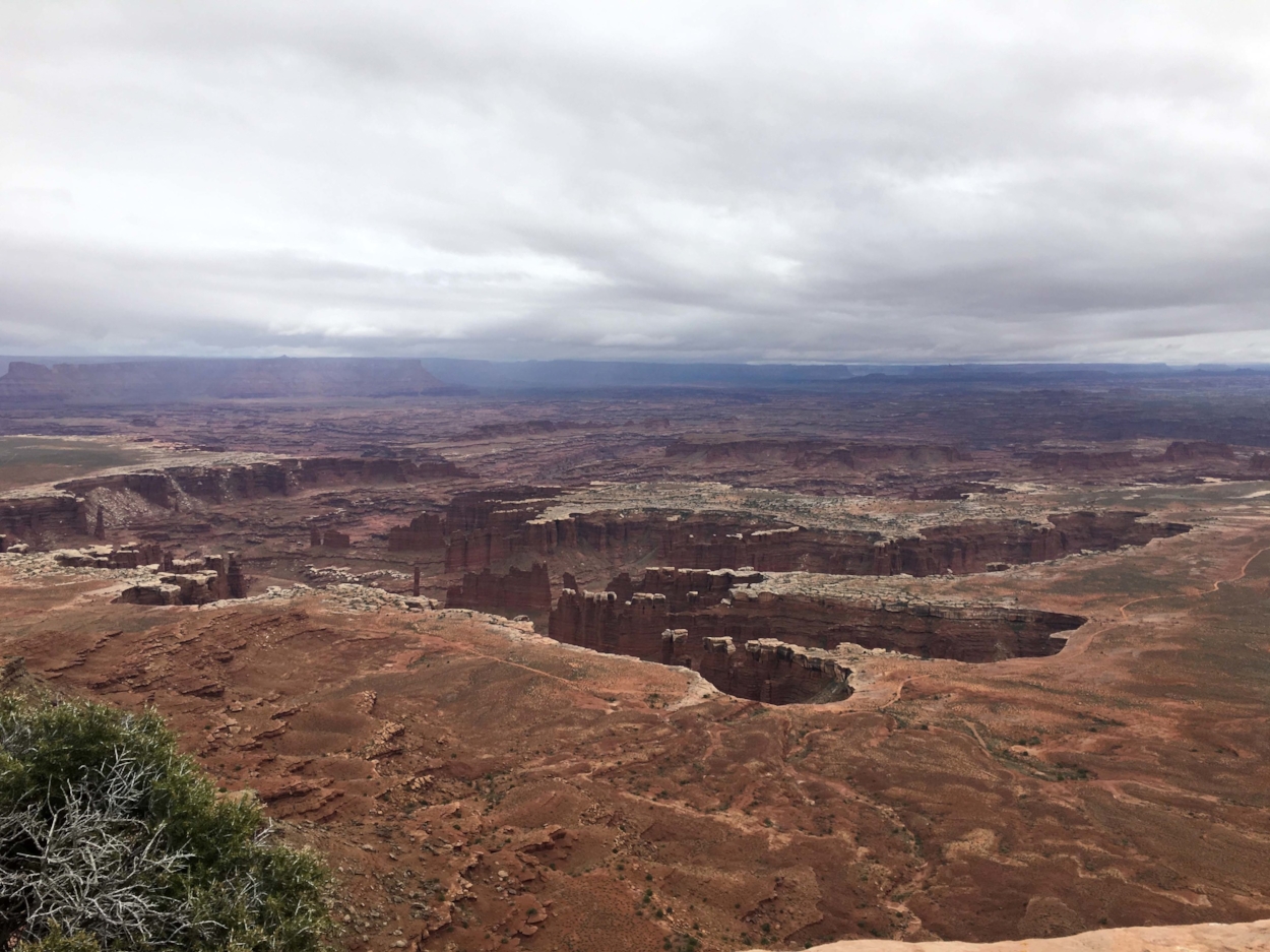
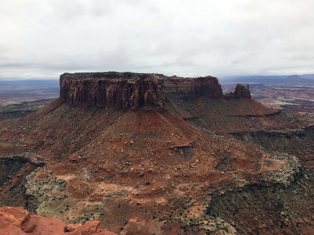
Island in the Sky at Canyonlands National Park is approximately fifty-minutes north and west of Arches, by car. Canyonlands is a hidden gem, the least visited and largest of the five Utah parks — you’ll get to explore this amazing location in relative quiet contemplation. The four sections of Canyonlands are Island in the Sky, The Needles, The Maze, and Horseshoe Canyon; they do not abut one another. The Needles and Island in the Sky are the most accessible with a standard vehicle from Moab. The Maze and Horseshoe Canyon involve descending into the canyons and require more planning, and in some cases a 4x4 vehicle with high clearance.
Altitude increases from Moab as you approach the visitors center, 2,000 feet up. A day of exploration here involves driving on paved roads, pausing at overlooks and walking out into the clouds to view canyons etched by the Colorado and Green Rivers. There is no shuttle service here either, so you’ll be once again be driving and parking, though presumably with less congestion than at Arches.
Travel Note: Camping, backpacking, four wheel driving, ATV and mountain bike use, and river boating all require permits, the best way to find out more is to call Canyonlands reservations 435.259.4351 Monday through Friday 8:00 a.m.- 12:00 p.m., mountain time. You can book a trip down into the canyon with a concessionaire — some offer multi-day boat tours that lead deep into the Maze; others will allows you to take an ATV down the switchbacks of Shaefer Trail.
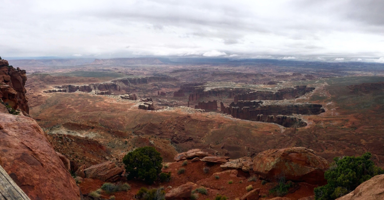
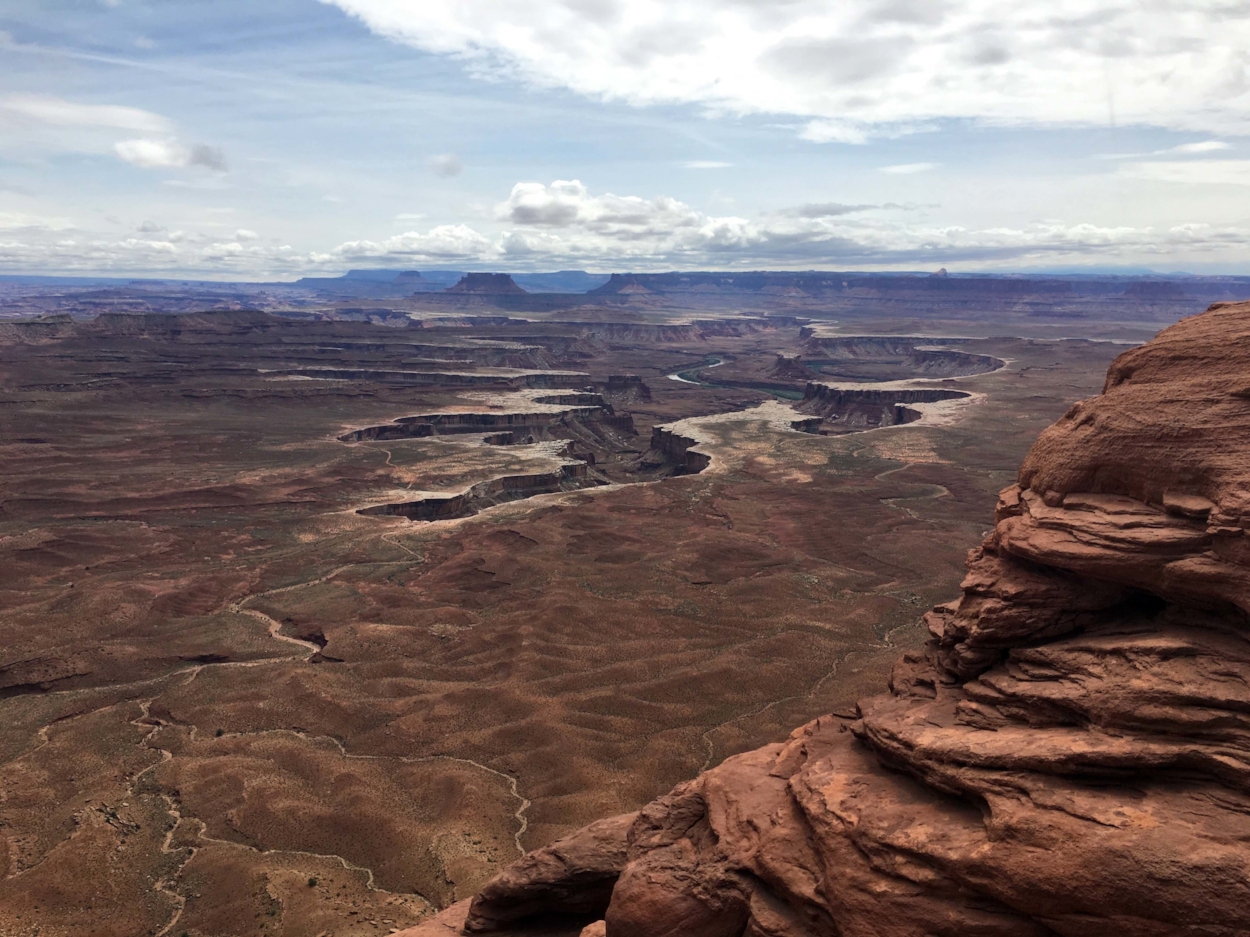
We suggest beginning at the end of the scenic drive, the Grand View Point Overlook. The view is otherworldly, downward and into quiet and dramatically carved canyons. The Colorado River cuts deep here, over 2,000 feet down from the trail, such that you can’t see it from above. A short one-mile trail leads from the parking area to a series of vistas, also featuring the Orange Cliffs and the Green River. The hike is designated as easy — while low intensity it is intensely memorable.
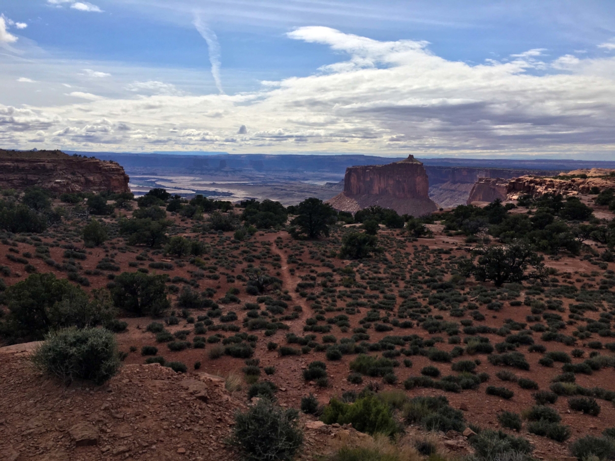
From here, you can wander at pace back toward the park entry, stopping along the way at Buck Canyon Overlook, Green River overlook, and Mesa Arch. Take the fork to Upheaval Dome, past the Whale Rock (yep, it looks just like a whale). There are three trails here. A one-mile round trip trail leads to the overlook of the Upheaval Dome, an eroded crater, theorized to be an impact crater, though it might be the remnants of a collapsed salt dome; a half-mile trail leads to a loftier overlook of the crater, and from the same trail head, you can take a tour around the entire crater called the Syncline Trail; a good four hour hike though parts are on a unmaintained path.
To explore The Needles, head one and a half hours south from Moab. The visitors’ center is at the very south end of the park. A short six-mile scenic drive takes you into the heart of The Needles, and offers a few easy trails right off the road, and many more strenuous trails further afield.
Return to Zion National Park
We returned to St. George, driving 2.5 hours and then stopping for the night in Richfield to break up the trip. Before heading to SGU, we explored the Kolob Canyons in Zion.
If you happen to visit between late-May and mid-October, consider a stop on the way back toward Zion at Cedar Breaks National Monument, where a very similar environment to Bryce Canyon exists, though with fewer visitors. Thirty minutes from I-15 just north of Cedar City, the road to the Cedar Breaks attains high altitude and is also not plowed by the state —thus the opening and closing of the park road varies a bit. Otherwise, the park is open for winter activities of skiing, snowshoeing and snowmobiling and hosts winter star parties for night sky viewing. We took the Kolob Canyon trail one mile up to gaze at the canyon, and then made haste for the airport, leaving the state with fresh mud on our hiking boots.
Other popular Parks & Points posts: