The Old Railroad Bridge in the Muscle Shoals National Heritage Area is a Feat of Engineering, Endurance, and Collaboration

Photo by Dave Reasons.
The 1,580 foot double-decker bridge is a community fixture within the Tennessee Valley Authority’s Muscle Shoals Trails Complex, and one of 121 unique sites within the Muscle Shoals National Heritage Area.

Photo by Dave Reasons.
What is a National Heritage Area?
Most people are familiar with the primary public lands designations—national parks, national forests, and national wildlife refuges; all offer abundant opportunities for recreation and learning. However, National Heritage Areas, established in the 1980s as “places where historic, cultural, and natural resources combine to form cohesive, nationally important landscapes” are often less touristed but no less enriching, and stewarded by the National Park Service, the same agency who looks after Yellowstone National Park, the Statue of Liberty, and the Washington Monument.
Unlike national parks, National Heritage Areas are large lived-in landscapes, protected in a unique partnership between the National Park Service and local non-profits “to make heritage relevant to local interests and needs.” The National Park Service offers technical assistance and distributes money from Congress to these organizations. Heritage Areas are unique pieces of the U.S. recreation and public lands game board—they aren’t defined by easily discoverable boundaries and they don’t have entry gates and fees, but you can often find several places within to stamp your NPS Passport, nonetheless!

Photo by Dave Reasons.
The Muscle Shoals National Heritage Area
Congress designated six counties in northwest Alabama’s Tennessee River Basin as part of the Muscle Shoals National Heritage Area in 2009, after more than a decade of advocacy from local groups. Its local nonprofit steward is located at Northern Alabama State University.
One hundred and twenty one sites reflect the intrinsic diversity of National Heritage Areas, and three themes track: the arts and music, the heritage of indigenous groups, and numerous sites for birding, walking, and outdoor recreation along the Tennessee River. To get a sense of the diversity, sites range from the Alabama Music Hall of Fame and FAME Music Studios, where artists from Wilson Pickett and Aretha Franklin to Bob Dylan to Alicia Keys have recorded, to contemporary fashion designer Billy Reid’s flagship store and studio in downtown Florence, Alabama and Alabama Chanin’s factory store and School of Making (where all items are hand-sewn from high-quality sustainably sourced cotton) to the Tennessee Valley Museum of Art. Serene and picturesque natural sites include Wheeler Lake, the North Alabama Birding Trail, the Seven Mile Island Wildlife Management Area, and the Old Railroad Bridge, within the Tennessee Valley Authority’s Muscle Shoals Trails Complex.


All above photos by Amy Beth Wright.

Photo by Dave Reasons.
The Old Railroad BridgE
Some wonders are natural, some manmade, and some, like the Old Railroad Bridge—the oldest river bridge in Alabama, connecting the towns of Florence and Sheffield—are a unique combination of both. The bridge now serves as a 1,560-foot walking trail over the Tennessee River at the TVA’s Muscle Shoals Trail Complex, where one can access 17 miles of foot trails. The walk leads to meditative views of the river and offers a strange and nourishing feeling of holding time between land and water, as, from Sheffield, it stretches to Patton Island and ends just shy of the Florence coastline.
To back”track,” the Florence Bridge Company first constructed the bridge in 1830; it opened as a toll bridge in 1840. Before that, there is documentation of indigenous groups like the Creek, Chickasaw, and Cherokee crossing here, as well as early settlers. Military forces crossed the water here during the War of 1812 and the Civil War, shortcutting the route to New Orleans. The Florence Ferry originated here in 1817.

Endurance
In its early years, the bridge was damaged twice by tornadoes; the Memphis and Charleston Railroad reopened it as a double-decker in 1858, with trains crossing on the upper deck and wagons and pedestrians crossing on the lower deck. In April of 1862 it was burned by the Confederate Army, and in 1864 the army commandeered its piers as a tie-off for pontoon boats. After reopening in 1870, it partially collapsed in 1892 when a steam locomotive crashed through both decks. Restructured with steel spans, the bridge again reopened in 1902, and in 1904 opened to electric streetcar and automobile traffic (which grew considerably over time, subsiding in 1939, when the nearby O’Neal Bridge opened). It remained an active train crossing on the upper deck through 1988, though the bottom deck was removed.

Collaboration
Norfolk Southern Railroad Company donated the bridge to The Old Railroad Bridge Company in 1990, a not-for-profit team of locals now led by officers Tim Wagnon (President), Bradley Askew (Vice President), Matthew Hea (Secretary), and Jim Green (Treasurer).
ORBC has developed an inspiring model for restoring and protecting the historic structure, as well as a visionary plan for how the bridge can serve as a vital community space, a setting for arts and health and wellness events, as well as holiday picnics and celebrations. Their efforts have spearheaded support to save the bridge from being dismantled and to commission a mural from local artist Scott Campbell; future endeavors include re-decking 949 boards and developing a bridge-to-island nature trail. The group can also foresee the bridge fitting within the Singing River Trail system in northern Alabama.
The bridge itself is not only a lovely river walk, but also a popular spot for cycling, graduation and prom photos, July 4 picnics and fireworks, sunset yoga and a martial arts clinic, a bluegrass festival, and musical events as part of the ten-day Handy Festival, which preserves the legacy of composer Florence native W.C. Handy (considered the father of the Blues, and the writer of “St. Louis Blues.”) ORBC’s wonderful website links to more local, state, and site history.

Further Exploring The Muscle Shoals Trail Complex

Waterfalls along the Rockpile Recreation Area, photo by Amy Beth Wright.
The Muscle Shoals Waterfall Walk is an accessible and easy .18 miles that leads to stunning views of the Wilson Dam, limestone bluffs, and the Tennessee River, as well as bird sightings, and of course, refreshing waterfalls. The Muscle Shoals Jogging Trail is a 3.13 mile loop that meanders through woodlands and open areas, linking to several smaller and more rugged trails. Per the TVA, this trail “also showcases the Hall Memorial Native Plant Garden which is home to over 2,000 native plants.” An excellent interpretative map detailing all trails within the TVA system (in Georgia, Alabama, Tennessee, and North Carolina) can be found here:
Along the river heading east, toward the dam, is a CCC park and pavilion and the Rockpile Recreation Area, a network of limestone bluffs and underwater caves, eroding every so slowly due to the higher acid content in the cascading water.
Read more about recreation opportunities here and here; the first links to details on hiking the Rockpile Trail, and the latter is from Alabama Birding Trails, which describes sightings of “waterfowl, wading birds, gulls, and raptors,” with Great Crested Flycatchers and visiting Baltimore or Orchard orioles spotted near the campground.
TVA History and Origin Story
President Roosevelt established the TVA as part of the New Deal in 1933 as “an independent agency of the federal government charged with broad responsibility for the unified development of all the resources of the Tennessee Valley.” This included flood control, navigation, land management, and electricity, supporting regional economic development in collaboration with local power companies.
The Muscle Shoals Reservation is on land that was historically eyed for nitrates and phosphorus, which were used in munitions and later, fertilizer. In 1916, explains Derek South, a Recreation Specialist with the TVA, it first became evident that the area was plentiful with nitrates, a suitable fuel source that could replace the use of imported guano from Chile. Construction began on two nitrate plants and the Wilson Dam in 1918. The more propulsive flow from the dam also settled the namesake shoals, sandbars and rocks that move frequently (particularly during storm events), rendering them less treacherous to steamship, ferry, and other water vessels, and allowing greater access to coastline towns. Though World War I ended before the plants, meant to run on hydroelectric power generated by the new dam, could be put to work, the dam eventually created needed hydroelectric power for weapons manufacturing during WWII, the Korean Conflict, and during the Cold War. Post-war, employees at Muscle Shoals developed new fertilizers and agricultural approaches, and today focus on engineering, preservation, and maintenance. The Wilson Dam is now one of 32 major dams within the TVA that regulates floods and supplies electricity (a key revenue source to sustain the TVA) and offers both recreational opportunities and protects the water supply for the Tennessee Valley.
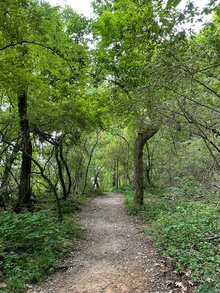
After being developed by the Civilian Conservation Corps, the reservation’s trails feature a lush forest interior, Pawpaw trees with rare, petite black flowers, bluebirds, and privet flowers. A research study between the NPS, the Southern Anthropological Institute, and Northwest Shoals Community College in Alabama also indicates that this site is part of the Trail of Tears, the home of Cherokee encampments in the 1830s. Read more on that work here.
https://historicbridges.org/bridges/browser/?bridgebrowser=alabama/florencerr/#photosvideos

Photo by Dave Reasons.